


Typhoon Wutip over Pacific may enter Philippines Thursday
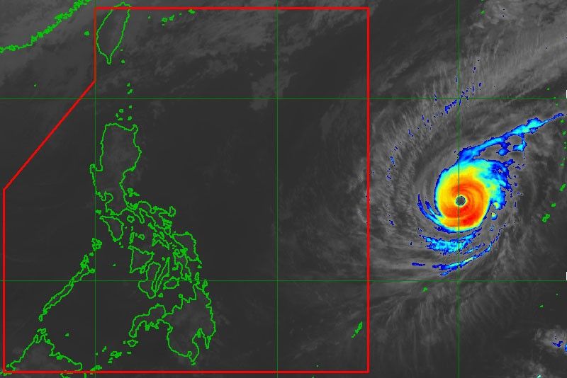
MANILA, Philippines — Typhoon Wutip, which is hovering over the Pacific Ocean, maintained its strength and is likely to enter the Philippine area of responsibility on Thursday, the weather bureau said yesterday.
However, Wutip, which will be locally named Betty once inside the Philippine area of responsibility, still poses no direct threat to any part of the country,” the Philippine Atmospheric, Geophysical and Astronomical Services Administration (PAGASA) said.
As of 3 p.m. yesterday, the center of Wutip was spotted at 1,725 kilometers east of Southern Luzon, packing winds of 185 kilometers per hour near the center and gustiness of up to 225 kph.
PAGASA senior weather specialist Aldczar Aurelio said Wutip was likely to move north northwest in the coming days.
Based on P AGASA’s latest forecast, Wutip might not pass near Philippine landmass.
Aurelio said fair weather would continue to prevail over the country, with cool temperatures expected in the evening until dawn brought by the northeast monsoon.
The name Wutip means butterfly. It is a name contributed by Macao S.A.R. (China) to the World Meteorological Organization.


- Latest
- Trending


