


'Inday' maintains strength, to exit PAR over the weekend
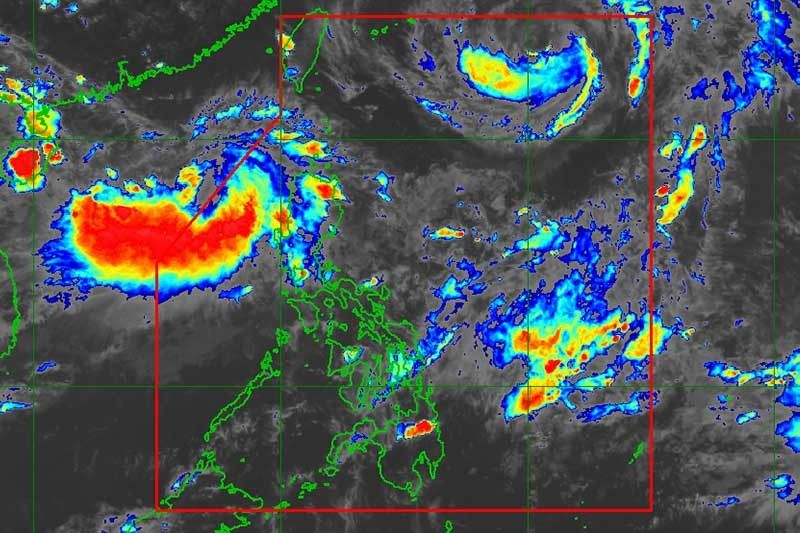
MANILA, Philippines — Severe Tropical Storm Inday kept its strength and gustiness and is expected to exit the Philippine Area of Responsibility between tonight or Saturday morning, the state weather bureau said.
"Inday" maintained its maximum sustained winds of 90 kilometers per hour and gustiness of up to 115 kilometers, according to the 5 p.m. weather bulletin of the PAGASA.
The tropical storm was last seen at 945 kilometers northeast of Basco, Batanes and will continue to enhance the southwest monsoon or habagat, bringing rains to Luzon in the next days.
PAGASA said it was also monitoring another low pressure area which was spotted at 435 kilometers west of Laoag City, Ilocos Norte. The LPA is expected to enter PAR this weekend.
The southwest monsoon which could bring moderate to occasionally heavy rains will continue to persist over Metro Manila, Ilocos region, Cordillera Administrative Region, Zambales, Bataan, Pampanga, Tarlac and Nueva Ecija.
The state weather bureau also warned of flooding specifically in low lying areas in the said regions and provinces. — Philstar.com intern Christian De Lano Deiparine


- Latest
- Trending


