


‘Quedan’ enters PAR
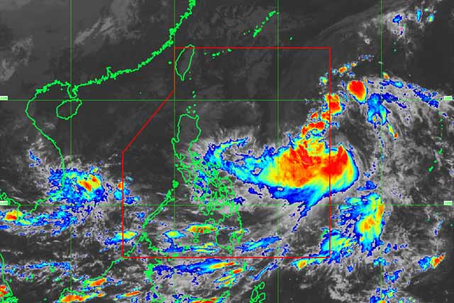
Satellite image of Tropical Storm Quedan. PAGASA/Released
MANILA, Philippines — Tropical Storm Quedan (international name: Saola) entered the Philippine area of responsibility on Wednesday afternoon.
In its latest advisory, the Philippine Atmospheric, Geophysical and Astronomical Services Administration said "Quedan" entered the country at 3 p.m.
Its eye was located at 1,170 kilometers east of Virac, Catanduanes. It packs maximum sustained winds of 80 kph and gustiness of up to 95 kph.
The tropical storm is forecast to move northwest at 21 kph.
PAGASA said Visayas and Bicol might experience cloudy skies with scattered rains and thunderstorm due to the tropical storm.
Aside from "Quedan," PAGASA said an Intertropical Convergence Zone is also affecting Palawan and Mindanao.
The state weather bureau warned residents of Palawan and Mindanao of cloudy skies with scattered rains and thunderstorms which might cause flooding or landslide.
Meanwhile, Metro Manila and the rest of Luzon might experience partly cloudy to cloudy skies with isolated light rains cause by northeasterly surface windflow. — Rosette Adel


- Latest
- Trending


