Flood warning up as Typhoon Jolina hits Phl
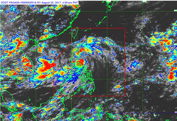
As of 4 p.m. yesterday, the center of Jolina was located at 110 kilometers south-southeast of Casiguran, Aurora. Screengrab from pagasa.dost.gov.ph
MANILA, Philippines - Flood warnings were issued in many parts of the country yesterday as Tropical Storm Jolina slammed into Northern Luzon, bringing heavy rains and strong winds.
Jolina, packing winds of 80 kilometers per hour near the center with gustiness that may reach up to 95 kph, was forecast to make landfall over Aurora between 6 p.m. and 9 p.m.
Heavy rain is expected to continue over Northern Luzon today, particularly the Ilocos region, as well as in the provinces of Zambales and Bataan as Jolina exits and moves to the West Philippine Sea.
Administrators of Magat Dam in Isabela opened floodgates yesterday as Jolina dumped more rains, according to Richard Orendain, hydrologist at the Philippine Atmospheric, Geophysical and Astronomical Services Administration (PAGASA).
The areas likely to be affected by flooding were Ramon, San Mateo, Aurora, Cabanatuan, Luna, Reina Mercedes, Burgos, Naguilian and Gamu.
Ipo Dam in Bulacan was also expected to release water last night or today. Water from Ipo Dam could inundate the areas of Norzagaray, Angat, San Rafael, Bustos, Baliuag, Pulilan, Plaridel and Hagonoy.
As of 4 p.m. yesterday, the center of Jolina was located at 110 kilometers south-southeast of Casiguran, Aurora.
It was forecast to move west-northwest at 19 kph.
Tropical cyclone warning signal No. 2 was hoisted over Isabela, Aurora, Quirino, Kalinga, Mountain Province, Ifugao, Ilocos Sur, Benguet, Abra, La Union and Nueva Vizcaya as of 5 p.m.
Signal No. 1 was raised over Cagayan, including Babuyan group of islands, Apayao, Ilocos Norte, Nueva Ecija, Pangasinan, Northern Quezon, including Polillo Island, and Camarines Norte.
After hitting Aurora, the center of Jolina was projected to cross Quirino, Nueva Vizcaya, Ifugao, Benguet, Mountain Province, La Union and Ilocos Sur.
PAGASA weather forecaster Aldczar Aurelio said the rest of Luzon, including Metro Manila, would continue to experience light to moderate rains today due to the enhanced southwest monsoon.
He said Jolina was forecast to exit landmass of Northern Luzon today and leave the Philippine area of responsibility on Sunday.
PAGASA said Jolina was also expected to move to Southern China like Tropical Storm Isang, which battered Hong Kong and Macau early this week.
But PAGASA weather division chief Esperanza Cayanan said unlike Isang which crossed mostly bodies of water, Jolina was expected to weaken after hitting mountainous areas of Aurora province.
She said Jolina – the 10th tropical cyclone this year – could reintensify once over the West Philippine Sea.
PAGASA officials also likened the track of Jolina to Tropical Storm Luming, which hit Northern Luzon in August 1977.
Luming left damage amounting to P2 million, PAGASA said.
Disaster alert
The National Disaster Risk Reduction and Management Council (NDRRMC) raised its disaster alert level to red over Northern and Central Luzon in anticipation of Jolina’s onslaught.
“Residents in these areas especially those under tropical storm signals two and one are alerted against possible flashfloods and landslides,” NDRRMC spokesperson Mina Marisagan said.
She added with the upcoming storm, all tourism activities such as hiking, trekking and caving are temporarily suspended, particularly in the Cordillera Administrative Region (CAR).
The NDRRMC raised the red alert since sea travel has become risky over the seaboard of Northern Luzon and in the eastern seaboards of Central and Southern Luzon.
“The NDRRMC through its regional and local disaster management councils is continuously monitoring the weather disturbance as well as other related hazards which may occur,” she said.
The Department of the Interior and Local Government (DILG) has directed local government units to undertake the necessary preparations following the raising of the disaster alert from blue to red.
As of 10 a.m., yesterday the center of the storm with maximum sustained winds of 80 kph was tracked 210 kilometers southeast of Casiguran, Aurora.
Ilocos Office of Civil Defense director Chito Castro said that disaster red alert has been declared over the region with all attached disaster units now on standby for possible response and relief operations.
The Department of Public Works and Highways (DPWH) announced the closure of Kennon Road on Friday going to Baguio City because of Jolina.
In a statement, the DPWH-CAR announced in its traffic advisory that Kennon Road would be closed to vehicular traffic effective 8 p.m. of Aug. 25, as Typhoon Jolina would likely spawn heavy rains in the next hours and may trigger landslides/rockslides.
Motorists going to and from Baguio City are advised to take Marcos Highway or Naguilian Road.
All national roads and bridges in Northern Luzon are passable to all types of vehicles based on the 5 p.m. situational report submitted by DPWH Region 1.
Classes from kindergarten to senior high school were suspended in Baguio City, Benguet, Abra, Ifugao and Kalinga due to the storm.
Authorities also banned hiking yesterday morning in Mt. Pulag and Mt. Purgatory in Benguet and Sagada, Mountain Province.
Classes at all levels were suspended in Cagayan, Isabela, Nueva Vizcaya and Quirino.
Jessie Geronimo, officer-in-charge of the Isabela Provincial Information Office, said Gov. Bojie Dy III has already declared the suspension of classes and the strong implementation of liquor ban and ‘no sailing, no fishing policy,’ upon the recommendation of the Provincial Disaster Risk Reduction and Management Office. – With Jaime Laude, Evelyn Macairan, Artemio Dumlao, Kurt dela Peña, Victor Martin


- Latest
- Trending