Panatag is proven PH territory; China claims it by bogus history

A civilian supply expedition to Panatag (Scarborough) is set this summer. The shoal is Philippine territory. Filipinos have every right to enter its 15,000-hectare lagoon bound by rocks and reefs.
Called Bajo de Masinloc by Zambales folk, it’s a high-tide elevation. Peaks protrude at full tide. It’s within Philippine 200-nautical mile exclusive economic zone, beyond other countries’ EEZs. That entitles it to 12-nm territorial sea under the 1982 UNCLOS.
Atin Ito is to allot food and gear to Panatag fishermen. It led last Christmas’ gift-giving to Marines at Ayungin (Second Thomas) Shoal and Kalayaan (Spratly) Isles off Palawan. Foreign observers are listing up for the next voyage.
Chinese coastguards menace Filipino fishermen at Panatag with machineguns and water cannons. Fish, sea turtles and fan corals thrive in the shallow waters three-and-a-half times Manila’s area. Chinese maritime militia poach endangered meter-long giant clams cultivated there 50 years ago by Filipino marine scientists.
China claims Panatag by fake history. Yuan Dynasty astronomer-engineer-mathematician Guo Shoujing purportedly sighted and surveyed the feature in 1279. How? By supposedly erecting a series of towers along China’s coast 650 nm away.
How distant is the sea horizon? A person 5’6” tall ashore can scan only up to 2.4 nm. If from an aircraft, then up to only 200 nm. China should stop demeaning Guo’s memory with lies.
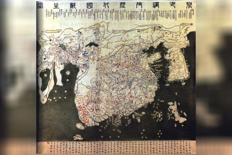
All ancient maps of China are published in “Atlas of Ancient Maps in China” by the People’s Republic of China. None of those maps includes Panatag, retired Supreme Court Justice Antonio Carpio notes. The southernmost Chinese territory is Hainan Island-province.
Only in its revised 1947 “China Handbook” did Beijing first claim the Spratlys, including Panatag. But it admitted that the Philippines and French Indochina also claimed the Spratlys, Carpio adds.
China calls the shoal Huangyan Dao. “Dao” means island, which Panatag is not. That betrays the China Communist Party’s invented history. Ignorant of navigation, landlubber commissars can’t distinguish between isle, reef, rock, cay, shoal, atoll. Ancient mariners defined “island” as seabound but with its own freshwater source.
The 1734 Murillo Velarde Map of the Philippines includes Panatag, then called Panacot. The Carta General del Archipielago Filipino, 1808 and 1875, classified it as “punto de mandato” or command post. French cartographers Nicolas Sanson and Jean-Baptiste Bourguignon D’Anville drew the Spratlys as Philippine territory in 1657 and 1752, respectively.
Commonwealth president Manuel Quezon dispatched patrols to Panatag starting 1935. The US State, Defense and Commerce departments had assured that no other country claimed it. The lighthouse, now decrepit, was internationally registered under the Philippines. After Independence, Philippine and US naval and air forces used a portion of Panatag for bombing practice. China was nowhere near.
China grabbed Panatag in 2012. In 2016 The Hague Permanent Court of Arbitration called it a “traditional fishing ground“ of Filipinos, Chinese and Vietnamese but upheld Philippine jurisdiction. Meaning, Manila can call Beijing and Hanoi to joint fisheries pacts under international and Philippine laws.
The Hague outlawed China’s nine-dash line or boundary over the entire South China Sea, encroaching the West Philippine Sea. That also favored Vietnam, Brunei, Malaysia and Indonesia, whose EEZs China illegally encompasses. Invoking The Hague ruling, the latter two registered with the UN their respective EEZ coverages.
China ignores the 2016 international verdict. President Xi Jinping in August 2023 instead stretched the nine-dash line to ten dashes, to cover Taiwan’s eastern coast. China’s sea claims bloat as fast as Xi’s ego. He has extended his terms as president and CCP boss. The ten-dash line can lengthen to 11 or 12 to envelop Okinawa, which Xi also claims by bogus narrative.
In 2021 Xi’s stamp-pad parliament authorized the China Coast Guard to fire at, board or seize any foreign vessel in the SCS. In December 2023 three giant CCG gunboats rammed and water-cannoned a Philippine fisheries bureau craft one-third their size. The Philippine crew was feeding and refueling Filipino fishers near but outside the shoal. People’s Liberation Army-Navy warships circled Panatag’s territorial waters.
* * *
Catch Sapol radio show, Saturdays, 8 to 10 a.m., dwIZ (882-AM).
Follow me on Facebook: https://tinyurl.com/Jarius-Bondoc


- Latest
- Trending