


'Tonyo' maintains strength ahead of expected exit from Philippines
MANILA, Philippines — PAGASA on Sunday afternoon said Tropical Depression Tonyo has kept its strength as it approaches the western boundary of the Philippine Area of Responsibility for its exit on Monday.
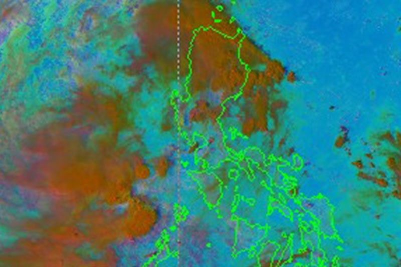
In its 5 p.m. bulletin, the weather bureau said Tonyo was last seen at 185 km west of Calapian City in Oriental Mindoro and continues to move southwestward at a speed of 25 kph.
It still has the strength of 45 kph maximum sustained winds as well as gusts of up to 55 kph, but the agency said Tonyo could still intensify into a tropical storm in the next 24 hours.
Tropical cyclone wind signals have since been lifted, but the weather disturbance is expected to continue bringing light to moderate with occasional heavy rains over Ilocos Region, CAR, Cagayan Valley, Aurora, as well as Palawan including Calamian and Kalayaan Islands.
The northeast monsoon, also known as the 'Amihan,' will also bring strong breeze to near gale conditions over Batanes, Babuyan Islands, Ilocos Norte, Apayao and northern portion of mainland Cagayan.
It will also bring rough to very rough seas with wave height reaching 2.5 to 4.5 meters over the seaboards of Batanes, Ilocos Norte, Ilocos Sur, and the northern seaboard of Cagayan as well as Babuyan Islands.
Moderate to rough seas, meanwhile, are expected due to Tonyo and the prevailing easterlies over the eastern seaboards of Cagayan Valley, Aurora, northern portion of Quezon and the northern and eastern seaboards of Catanduanes.
"Mariners of small seacrafts are advised to take precautionary measures when venturing out to sea. Inexperienced mariners should avoid navigating in these conditions," PAGASA added.
Tonyo is the 20th storm to hit the Philippines this year, with the weather bureau also reminding that one to three more storms may enter the country this month.
PAGASA in October announced the onset of the La Niña in the Philippines, where above normal rainfall conditions will prevail at least until March 2021.
Forecast Position
- Monday afternoon: 855 km West of Southern Luzon — Christian Deiparine

Tropical Depression Tonyo has made landfall over Torrijos, Marinduque at 4:30 a.m. on Sunday, state weather bureau PAGASA says.
The weather bureau forecasts Tonyo to move west-northwestward and make landfall in the vicinity of Sariaya, Quezon or San Juan, Batangas.
At 7 a.m., Tonyo was locate 70 km southwest of Alabat, Quezon or 40 km south southwest of Tayabas, Quezon. It bears winds of 45 kph and gusts of up to 60 kph. It is moving west northwestward at 25 kph.
All tropical cyclone warning signals have been lifted as Tropical Depression Tonyo moves over the West Philippine Sea on Sunday afternoon.
The weather disturbance is forecast to exit the Philippine Area of Responsibility on Monday morning.
At 4 p.m., Tonyo was seen 185 km west of Calapan City, Oriental Mindoro with maximum sustained winds of 45 kph and gustiness of up to 55 kph. It is moving southwestward at 25 kph.
Tropical Depression Tonyo is forecast to intensify into a tropical storm within the next 24 hours as it moves to exit the Philippine area of responsibility.
At 1 p.m., Tonyo was located 105 km west of Calapan City, Oriental Mindoro, bearing winds of 45 kph and gusts of 60 kph. It is moving west at 30 kph.
Signal No. 1 is still hoisted over the northwestern portion of Occidental Mindoro (Abra de Ilog, Paluan, Mamburao, Santa Cruz) including Lubang Island.
Tropical Depression Tonyo has made landfall over San Juan, Batangas at around 8 a.m. on Sunday.
State weather bureau PAGASA says the cyclone will emerge over the West Philippine Sea Sunday morning or afternoon and exit the Philippine Area of Responsibility by Tuesday morning.
At 10 a.m., Tonyo was located in the vicinity of Lobo, Batangas with maximum sustained winds of 45 kph and gusts of up to 60 kph. It is moving west northwestwards at 25 kph.
Tropical cyclone wind signal no. 1 is raised in:
- the northern and central portions of Quezon (Gumaca, Pitogo, Quezon, Alabat, Perez, Unisan, Plaridel, Atimonan, Agdangan, Padre Burgos, Pagbilao, Mauban, Tayabas City, Lucena City, Sariaya, Candelaria, Tiaong, San Antonio, Dolores, Lucban, Sampaloc, Real, Infanta, General Nakar) including Polillo Islands
- Cavite
- Laguna
- Rizal
- Batangas
- Metro Manila
- Bataan
- Bulacan
- Pampanga
- the southern portion of Aurora (Dingalan)
- the southern portion of Zambales (San Marcelino, San Felipe, San Narciso, San Antonio, Castillejos, Subic, Olongapo City)
- Marinduque
- the northern portion of Romblon (Romblon, San Andres, Calatrava, San Agustin, Corcuera, Banton, Concepcion)
- the northern and central portions of Oriental Mindoro (Bongabong, Bansud, Gloria, Pinamalayan, Socorro, Pola, Naujan, Victoria, Calapan City, Baco, San Teodoro, Puerto Galera)
- the northern and central portions of Occidental Mindoro (Sablayan, Santa Cruz, Mamburao, Paluan, Abra de Ilog) including Lubang Island


- Latest
- Trending


