


Potential storm may enter PAR ahead of Christmas
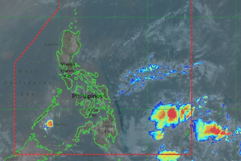
MANILA, Philippines — State weather bureau PAGASA is monitoring two low pressure areas, one of which may become a tropical cyclone before Christmas.
One LPA was located 795 kilometers east southeast of Hinatuan, Surigao del Sur inside the Philippine area of responsibility as of 3 a.m.
This will bring rains over the northeastern section of Mindanao. PAGASA said heavy rainfall warnings will be raised any time of the day in affected areas.
Another LPA estimated at 2,650 kilometers south of Mindanao may enter PAR by Monday.
PAGASA weather forecaster Loriedin dela Cruz said the second LPA may potentially become a tropical cyclone as it comes closer to the country's landmass.
The second LPA is seen to bring heavy rains over the southern part of Visayas and Mindanao on Tuesday, Christmas eve.
Meanwhile, the easterlies will bring cloudy skies with isolated rainshowers and thunderstorms over Cagayan, Isabela, Aurora and Quezon.
Metro Manila and the rest of the country will experience partly cloudy to cloudy skies with isolated rainshowers or thunderstorms brought about by the easterlies. — Patricia Lorudes Viray


- Latest
- Trending


