


Potential super typhoon approaching Philippines
MANILA, Philippines — A low-pressure area over Batanes intensified into a tropical depression yesterday even as a potential super typhoon continued to move toward the northern portion of the country.
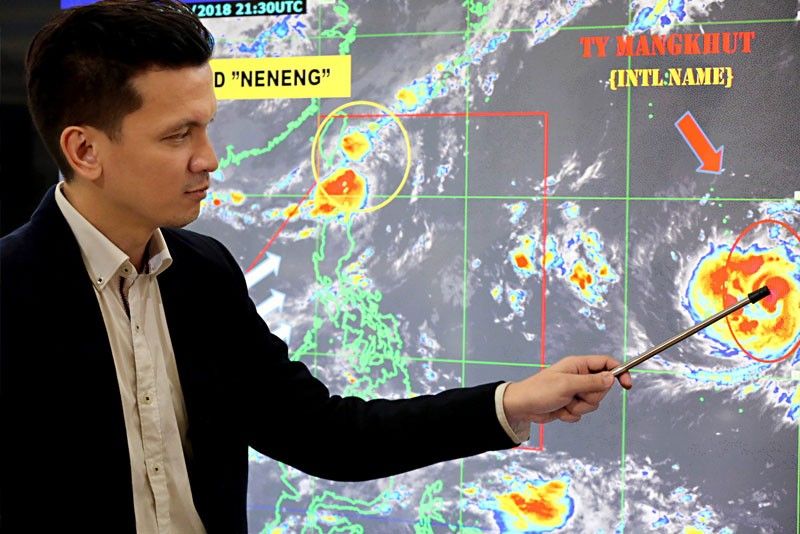
The Philippine Atmospheric, Geophysical and Astronomical Services Administration (PAGASA) said Typhoon Mangkhut, which will be given the local name Ompong, continued to intensify over the Pacific and is expected to enter the country tomorrow afternoon.
Senior weather forecaster Aldczar Aurelio said Mangkhut is likely to make landfall over the Cagayan-Batanes area.
He said the southwest monsoon, which will be enhanced by Mangkhut, would bring rains over Southern Luzon, the Visayas and Mindanao beginning tomorrow.
Heavy rains and strong winds from Mangkhut will be felt in Northern and parts of Central Luzon beginning Thursday, he said.
“While it is still far, we urge the public to prepare for this typhoon. Look for safe areas as heavy rains may trigger flooding and landslides. It is also expected to bring strong winds,” Aurelio said.
According to PAGASA weather specialist Ezra Bulquerin, Mangkhut could still intensify into a super typhoon while over the sea.
PAGASA categorizes a cyclone with maximum sustained winds of 220 kilometers per hour (kph) as a super typhoon.
The typhoon was expected to hit Guam and parts of Northern Mariana Islands yesterday.
As of 3 p.m., the eye of Mangkhut was estimated at 2,255 kilometers east of Southern Luzon, packing winds of 150 kph and gustiness of up to 185 kph.
It was moving west at 35 kph.
Based on the latest forecast by the US Joint Typhoon Warning Center, Mangkhut is likely to cross the Babuyan Group of Islands on Saturday morning with a strength of 240 kph near the center.
The rest of Northern Luzon will have rains and gusty winds during Mangkhut’s passage, particularly the rest of Region 1 and Cordillera Administrative Region due to its outer circulation.
The rest of Luzon will likely have cloudy skies with occasional to intermittent light to moderate rains, becoming at times heavy in the western side of Central Luzon due to the southwest monsoon.
Meanwhile, Tropical Depression Neneng will also bring moderate to occasionally heavy rains over Babuyan and scattered rainshowers and thunderstorms over Ilocos Norte and Apayao.
PAGASA placed Batanes under tropical cyclone warning signal number 1 as of 5 p.m. yesterday due to expected rains and gusty winds.
Occasional rains and gusty winds are expected over Batanes within the next 36 hours, PAGASA added.
As of 4 p.m., the weather disturbance was located at 150 km north northwest of Basco, Batanes with maximum sustained winds of 55 kph near the center and gustiness of up to 65 kph.
It is forecast to move west northwest at 10 kph.
Neneng is expected to exit the Philippine area of responsibility today.
Government is ready
The government is bracing for the onslaught of Mangkhut, believed to become a super typhoon once it enters the Philippines.
President Duterte has reportedly monitored the movement of the typhoon.
Presidential spokesman Harry Roque Jr. said yesterday that government has already put in place the necessary measures once the typhoon enters the country.
“The government has already notified all the agencies concerned for the proper response when the time comes,” Roque said.
Roque added that relief goods have been stored in strategic points also in coordination with local government units in areas to be affected by the storm.
“People should be ready always and prepare their emergency kits. They should also evacuate when necessary,” Roque further said in Filipino.
Meanwhile, Sen. Ralph Recto called on the Duterte administration to brace for the typhoon instead of being focused on political storms.
“It should be able to distinguish between a tempest in a teacup involving a few and a (storm that) may put millions in harm’s way. Communications-wise, what the public ought to hear is a steady stream of typhoon information, not the gale-force rhetoric from some bully pulpit,” Recto said.
The senator said the government can begin by calling a command conference of all agencies in its national disaster body, where an order to help civilians weather a powerful storm and reduce human casualty is issued. – With Edith Regalado, Eva Visperas, Rudy Santos


- Latest
- Trending


