


‘Bising’ to dump rains in Cebu
CEBU, Philippines — Metro Cebu and the rest of the province will experience cloudy skies with rainshowers and/or thunderstorms today until possible Wednesday due to Typhoon Bising.
The Philippine Atmospheric, Geophysical and Astronomical Services Administration (PAGASA) said that Typhoon Bising, the second weather disturbance to enter the Philippine area of responsibility, will move generally northwestward over the Philippine Sea until this afternoon.
Earlier in the day yesterday, the Coast Guard Station Central Cebu cancelled some sea trips due to the signal warning number 1 hoisted in some parts of the country, including Cebu’s Camotes Islands.
All types of vessel/watercrafts sailing the different routes in the Visayas, particularly those plying to the routes of Northern and Eastern Samar, Samar, Biliran, Southern Leyte, Leyte and Camotes Islands, have been temporarily suspended.
CGS Central Cebu acting commander Alvin Dagalea, in his Notice to Mariners No. 0421-002, said this is a proactive measure in order to avert maritime accidents.
In Danao City, Cebu, the City Disaster Risk Reduction and Management Office yesterday reported at least 50 stranded passengers supposedly bound for Camotes.
The local government brought them to a temporary shelter in Barangay Poblacion and gave them food packs as well.
According to PAGASA Severe Weather Bulletin #5 issued at 5 p.m. yesterday, Camotes Islands was no longer under tropical cyclone warning signal no. 1 but Northern Samar, Eastern Samar and Samar remained under that category.
The bulletin showed that rough to high seas (3 to 10 meters) will be experienced over the eastern seaboards of Luzon and areas where TCWS is in effect while rough to very rough seas (2.8 to 4.5 m) over the remaining seaboards of Northern Luzon and eastern seaboards in Mindanao (that are not under TCWS).
“Sea travel is risky for all types of seacrafts over these waters, especially those under Tropical Cyclone Wind Signal (TCWD),” the state weather bureau said.
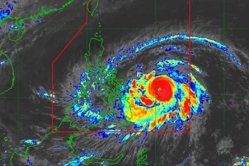
Based on PAGASA’s 24-hour Weather Forecast and Extended Weather Outlook issued yesterday, the eye of Typhoon Bising (international name Surigae) was located at 470 kilometers East of Guian, Eastern Samar with maximum sustained winds of 195 kilometers per hour near the center .
It had a gustiness of up to 240 kilometers per hour and was moving west northwestward at 25 kilometers per hour.
The typhoon is expected to slow down and move northward or north-northeastward until Tuesday afternoon before moving generally northward or north-northwestward over the Philippine Sea east of Northern and Central Luzon.
“Considering the uncertainty in the track forecast of Typhoon Bising, a westward shift in the current forecast track may result in potentially significant impacts over the eastern portions of Southern Luzon and Visayas,” the weather bureau said.
Typhoon Bising is forecast to further intensify and reach its peak intensity (up to 205 km/h) today. – JMD (FREEMAN)


- Latest


