


Typhoon 'Paeng' exits; new cyclone to enter Philippines
MANILA, Philippines — Typhoon Paeng is expected to exit the Philippine area of responsibility today, but a new cyclone is forecast to enter the country next week.
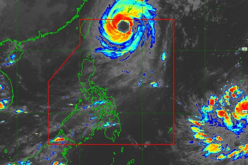
Paeng will continue to bring “very rough seas,” with waves as high as 4.5 meters along the northern and eastern seaboards of Luzon and eastern seaboard of the Visayas, the Philippine Atmospheric, Geophysical and Astronomical Services Administration (PAGASA) said.
As of 3 p.m. yesterday, the eye of Paeng was located 615 kilometers east northeast of Basco, Batanes with maximum sustained winds of 60 kilometers per hour and gustiness of up to 195 kph. It is forecast to move northwest at 15 kph.
Meanwhile, PAGASA weather specialist Ezra Bulquerin said a low-pressure area spotted off Mindanao has developed into a tropical depression and is likely to enter the country on Tuesday.
As of 2 p.m., the tropical depression, which will be locally named Queenie, was spotted 2,625 kms east of Mindanao with maximum sustained winds of 45 kph and gustiness of up to 60 kph.
Bulquerin could not say yet whether the new cyclone would make a landfall.


- Latest
- Trending


