'Maring' slightly intensifies, barrels toward Quezon-Aurora
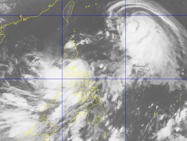
Satellite image shows Tropical Depression Maring moving west northwest on Tuesday, Sept. 12, 2017. PAGASA
MANILA, Philippines — Tropical Depression Maring has slightly intensified on Tuesday morning as it barrels toward Quezon-Aurora area where it is expected to make landfall in the afternoon.
Based on available data, "Maring" is packing winds of up to 55 kilometers per hour near the center and gustiness of up to 65 kph, according to the Philippine Atmospheric, Geophysical and Astronomical Services Administration.
"At 4:00 AM today, the center of Tropical Depression "MARING" was estimated based on all available data at 80 km North of Daet, Camarines Norte," the state weather bureau said in its 5 a.m. bulletin Tuesday.
"Maring," moving west northwest at 11 kph, is expected to make landfall on Tuesday afternoon over Quezon-Aurora area.
Tropical Cyclone Warning Signal No. 1 has been raised over the following areas:
- Metro Manila
- Catanduanes
- Camarines Norte
- Camarines Sur
- Northern Quezon including Polillo Island
- Rizal
- Bulacan
- Pampanga
- Quirino
- Nueva Ecija
- Nueva Vizcaya
- Benguet
- La Union
- Tarlac
- Zambales
- Bataan
- Pangasinan
- Laguna
- Quirino
- Aurora
Rice crops on their flowering state may suffer significant damage in these locations, PAGASA said. Wave height is also estimated to be between 1.25 to 4 meters
PAGASA said the tropical depression can bring moderate to heavy rain in Bicol region, CALABARZON, MIMAROPA, Metro Manila, Central Luzon and Pangasinan. Residents of these areas are warned against possible landslide and flashfloods.
It also advised the public to remain alert as sea travel remains risky over the eastern seaboards of Aurora, Quezon and Bicol region.
Typhoon Lannie, according to PAGASA, is not directly affecting the country.
The center of "Lannie" is spotted at 1,190 kilometers east of Aparri, Cagayan, with packing winds of 55 kph and gustiness of up to 65 kph. It is moving west northwest toward Batanes-Taiwan at 26 kph.
No areas are placed under tropical cyclone warning signals due to "Lannie."
Both "Maring" and "Lannie" were forecast to exit the Philippine area of responsibility on Thursday.


- Latest
- Trending