Signal No. 3 still up in Metro Manila as ‘Paeng’ threatens capital region, other areas
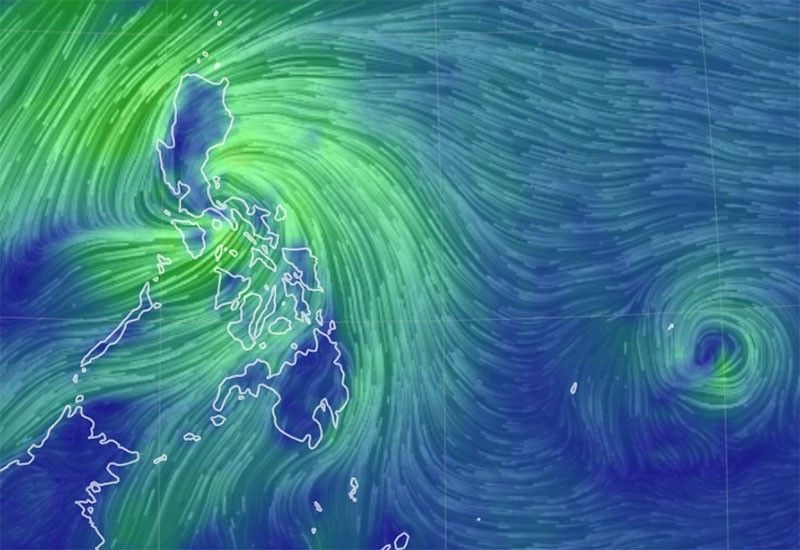
MANILA, Philippines (Update 2, 4:03 p.m.) — Tropical Cyclone Wind Signal No. 3 remained hoisted over Metro Manila and several other areas as Severe Tropical Storm Paeng (international name: Nalgae) may cross the capital region and nearby provinces on Saturday.
PAGASA said in a bulletin issued at 2 p.m. on Saturday that after Paeng makes landfall in the vicinity of San Juan, Batangas, it may cross the Cavite-Metro Manila-Bataan peninsula area for the rest of the day.
Earlier Saturday, Paeng made its third landfall over Buenavista, Quezon at 6 a.m. on Saturday and its fourth landfall over Santa Cruz, Marinduque at 8:40 a.m.
Paeng was last spotted over the coastal waters of San Juan, Batangas moving west northwestward at 15 kph packing winds of 95 kph near the center and gusts of up to 130 kph.
Aside from Metro Manila, Signal No. 3 is up in the following areas which can expect winds of greater than 89 kph to 117 kph in at least 18 hours:
- Bataan
- Southern portion of Zambales (Olongapo City, Subic, Castillejos, San Antonio)
- Marinduque
- Northern and central portions of Quezon (Pitogo, Lucena City, Pagbilao, Infanta, Tiaong, Unisan, Plaridel, San Antonio, Candelaria, Lucban, Sampaloc, Padre Burgos, Sariaya, City of Tayabas, Mauban, Dolores, General Nakar, Agdangan, Gumaca, Atimonan, Real, Macalelon, General Luna, Catanauan) including Pollilo Islands
- Laguna
- Batangas
- Cavite
- Rizal
- Northwestern portion of Occidental Mindoro (Paluan, Abra de Ilog) including Lubang Islands
- Northern portion of Oriental Mindoro (San Teodoro, Puerto Galera, Baco, City of Calapan, Naujan)
Signal No. 2, meanwhile, is up in the following areas which can expect winds of 62 kph to 88 kph in at least 24 hours:
- Southern portion of Aurora (San Luis, Baler, Dingalan, Maria Aurora)
- Bulacan
- Nueva Ecija
- Pangasinan
- Pampanga
- Tarlac
- Rest of Zambales
- Western and northwestern portions of Camarines Sur (Siruma, Tinambac, Ocampo, Goa, Lagonoy, Milaor, Nabua, Buhi, Baao, Bato, Camaligan, Pili, Tigaon, Garchitorena, Iriga City, San Fernando, Magarao, Minalabac, Balatan, Naga City, Calabanga, Bombon, Bula, Canaman, Saglay, San Jose, Gainza, Sipocot, Del Gallego, Ragay, Lupi, Pasacao, Cabusao, Libmanan, Pamplona)
- Rest of Oriental Mindoro
- Rest of Occidental Mindoro
- Romblon
- Camarines Norte
- Rest of Quezon
- Northern and central portions of Albay (Tiwi, Malinao, Libon, City of Tabaco, Polangui, Oas, City of Ligao, Guinobatan, Pio Duran)
- Burias Island
- Northwestern portion of Antique (Libertad, Pandan, Caluya Islands)
- Western portion of Aklan (Buruanga, Malay, Nabas, Ibajay, Tangalan, Makato, Numancia, Lezo)
Signal No. 1 is hoisted over the following areas which can expect winds of 39 kph to 61 kph or intermittent rains within 36 hours.
- Isabela
- Nueva Vizcaya
- Quirino
- La Union
- Kalinga
- Abra
- Benguet
- Ifugao
- Mountain Province
- Ilocos Sur
- Rest of Aurora
- Catanduanes
- Rest of Camarines Sur
- Rest of Albay
- Sorsogon
- Rest of Masbate including Ticao Island
- Northern portion of Palawan (El Nido, Taytay, Dumaran, Araceli, Roxas, San Vicente) including Calamian Islands and Cuyo Islands
- Northern and central portions of Eastern Samar (Quinapondan, Can-Avid, Lawaan, Maslog, Balangiga, City of Borongan, San Policarpo, Taft, Llorente, Maydolong, Dolores, Giporlos, Jipapad, Oras, Arteche, Balangkayan, Sulat, San Julian, General Macarthur, Hernani)
- Samar
- Northern Samar
- Leyte
- Northern and central portions of Cebu (Daanbantayan, Medellin, San Remigio, Tabogon, City of Bogo, Borbon, Tabuelan, Sogod, Catmon, Tuburan, Carmen, Danao City, Asturias, Balamban, Compostela, Liloan, Cebu City, Mandaue City, Consolacion, Toledo City, City of Talisay, City of Naga, Pinamungahan, Minglanilla, Aloguinsan, San Fernando, City of Carcar, Barili, Sibonga, Dumanjug, Argao, Alcantara, Moalboal, Ronda, Lapu-Lapu City, Cordova, Badian, Dalaguete) including Bantayan and Camotes Islands
- Biliran
- Northern portion of Bohol (Talibon, Getafe, Buenavista, Inabanga, Clarin, Tubigon, Calape, Bien Unido, Loon)
- Negros Occidental
- Northern and central portions of Negros Oriental (City of Guihulngan, Vallehermoso, Canlaon City, La Libertad, Jimalalud, Tayasan, Bais City, City of Bayawan, Manjuyod, Basay, Bindoy, Mabinay, Ayungon, City of Tanjay)
- Guimaras
- Rest of Antique
- Rest of Aklan
- Capiz
- Iloilo
PAGASA warns that there is minimal to moderate risk of a storm surge up to two meters in height in western Pangasinan, Zambales, Bataan, southern Aurora, Quezon including Polillo Islands, Bulacan, Metro Manila, Cavite, Batangas, Marinduque, Camarines Norte, Camarines Sur and Albay.
On Saturday, PAGASA forecasts that Metro Manila, CALABARZON, Bicol Region, Marinduque, Romblon, Mindoro Provinces, and the northern portion of Palawan including Calamian and Cuyo Islands will experience heavy to intense with at times torrential rains.
In the same period, mainland Cagayan Valley, Cordillera Administrative Region, Western Visayas, and Central Luzon will likely experience moderate to heavy with at times intense rains.
The rest of Luzon and Visayas, meanwhile, will experience light to moderate with at times heavy rains.
The following day, Zambales, Bataan and the Ilocos region will likely experience moderate to heavy with at times intense rains.
Meanwhile, Metro Manila, Mimaropa, the rest of Calabarzon, and the rest of Central Luzon will experience light to moderate with at times heavy rains.
“Under these conditions, widespread flooding and rain-induced landslides are expected, especially in areas that are highly or very highly susceptible to these hazards,” PAGASA said.
PAGASA said Paeng may weaken into a tropical storm due to its interaction with the Luzon landmass. It may re-intensify into a severe tropical storm when it reaches the West Philippine Sea, the state weather service said. — Xave Gregorio


- Latest
- Trending