Tropical depression may enter PAR by Thursday
MANILA, Philippines — An incoming tropical cyclone may intensify into a typhoon before it enters the Philippine area of responsibility as Josie.
The Philippine Atmospheric, Geophysical and Astronomical Services Administration (PAGASA) said the cyclone was expected to intensify into a tropical storm in the last 24 hours and further intensification could take place.
The cyclone is forecast to enter the Philippine area of responsibility by Thursday afternoon or evening.
“By Thursday, improving environmental conditions will enable the tropical cyclone to intensify at a relatively faster rate. Current forecast scenario shows that this tropical cyclone will enter the Philippine area of responsibility as a typhoon,” PAGASA said in an advisory.
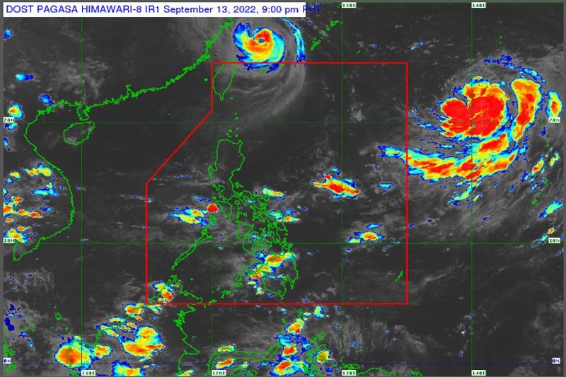
The cyclone was estimated at 1,785 km East of Extreme Northern Luzon as of 10 a.m.
It was carrying maximum sustained winds of 55 km/h near the center, with a gustiness of up to 70 km/h.
It is forecast to remain far from the Philippine landmass and will not directly affect the weather condition in the country, but may enhance the southwest monsoon.
The monsoon will bring isolated rainshowers over Metro Manila and the rest of the country.
Meanwhile, Typhoon Inday left the Philippine area of responsibility at 12:40 a.m. yesterday.
It was expected to slowly weaken or maintain its strength while tracking over the East China Sea.


- Latest
- Trending