


‘Caloy’ almost stationary over West Philippine Sea, enhances ‘habagat’
June 29, 2022 | 9:12am
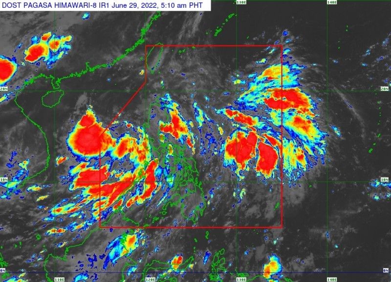
Satellite rendering of Tropical Depression Caloy as of 5:30 a.m. on Wednesday, June 29, 2022.
PAGASA
MANILA, Philippines (Updated, 12:06 p.m.) — Tropical Depression Caloy, which is now almost stationary over the West Philippine Sea, is enhancing the southwest monsoon or habagat, the state weather bureau said Wednesday.
PAGASA said the center of Caloy was seen 375 kilometers west of Iba in Zambales province, with peak winds of 45 kph and gusts of up to 55 kph.
Caloy is forecast to “remain almost stationary,” it added.
Weather forecasters advised those living in areas identified to be highly or very highly susceptible to hazards to follow evacuation and other instructions from local officials.
What to expect?
- According to PAGASA, the monsoon trough and the southwest monsoon enhanced by Caloy will dump monsoon rains over the western sections of Luzon and Visayas.
- No tropical cyclone wind signal is currently hoisted, but the enhanced southwest monsoon will bring occasionally gusty conditions reaching strong breeze to near gale in strength over Extreme Northern Luzon, and the western sections of Luzon and Visayas. Weather forecasters said these conditions are more likely in coastal and mountainous localities of these areas.
- Caloy and the enhanced southwest monsoon will trigger moderate to rough seas (1.2 to 3.4 m) over the seaboards of Northern Luzon and the western seaboards of Central and Southern Luzon. These conditions may be risky for those using small seacrafts.
- The tropical depression may exit the Philippine Area of Responsibility within 24 hours. But the track and intensity forecast may still change due to the present nature of Caloy’s circulation.
- PAGASA also said the large overall circulation and disorganized structure of Caloy suggest a slow pace of intensification in the near term. It may reach tropical storm category by Friday afternoon.
Track forecast
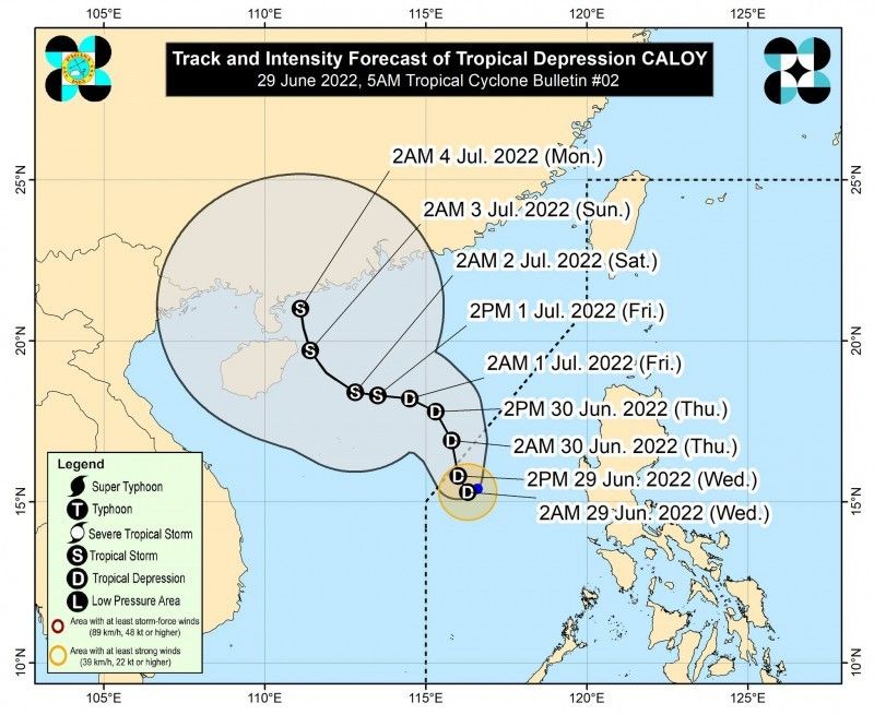
Forecast track of tropical cylone Caloy as of 5:30 a.m. on Wednesday, June 29, 2022.
PAGASA
Track forecast
- Thursday morning: 600 west northwest of Iba, Zambales (Outside PAR)
- Friday morning: 810 km west of Northern Luzon (Outside PAR)
- Saturday morning: 995 km west of Northern Luzon (Outside PAR)
- Sunday morning: 1,195 km west of Extreme Northern Luzon (Outside PAR)
- Monday morning: 1,210 km west of Extreme Northern Luzon (Outside PAR)
— Gaea Katreena Cabico
BrandSpace Articles


<
>
Philstar
x
- Latest
- Trending
Trending
Latest
Trending

By Romina Cabrera | 22 hours ago

By Rosette Adel | 2 days ago

By Bella Cariaso | 22 hours ago

By Bella Cariaso | 22 hours ago

Latest


By Patrick Miguel | 22 hours ago

By Daphne Galvez | 22 hours ago

By Rudy Santos | 22 hours ago

By Elijah Felice Rosales | 22 hours ago

Recommended
22 hours ago

1 day ago
2 days ago

2 days ago
