4 areas under Signal No. 1 as 'Kiko' moves over Philippine Sea
MANILA, Philippines — State weather forecasters placed four areas in Northern Luzon under Tropical Cyclone Wind Signal No. 1 as Typhoon Kiko (Chanthu) continued to move over the Philippine Sea.
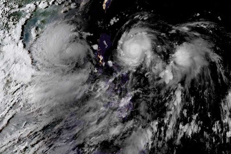
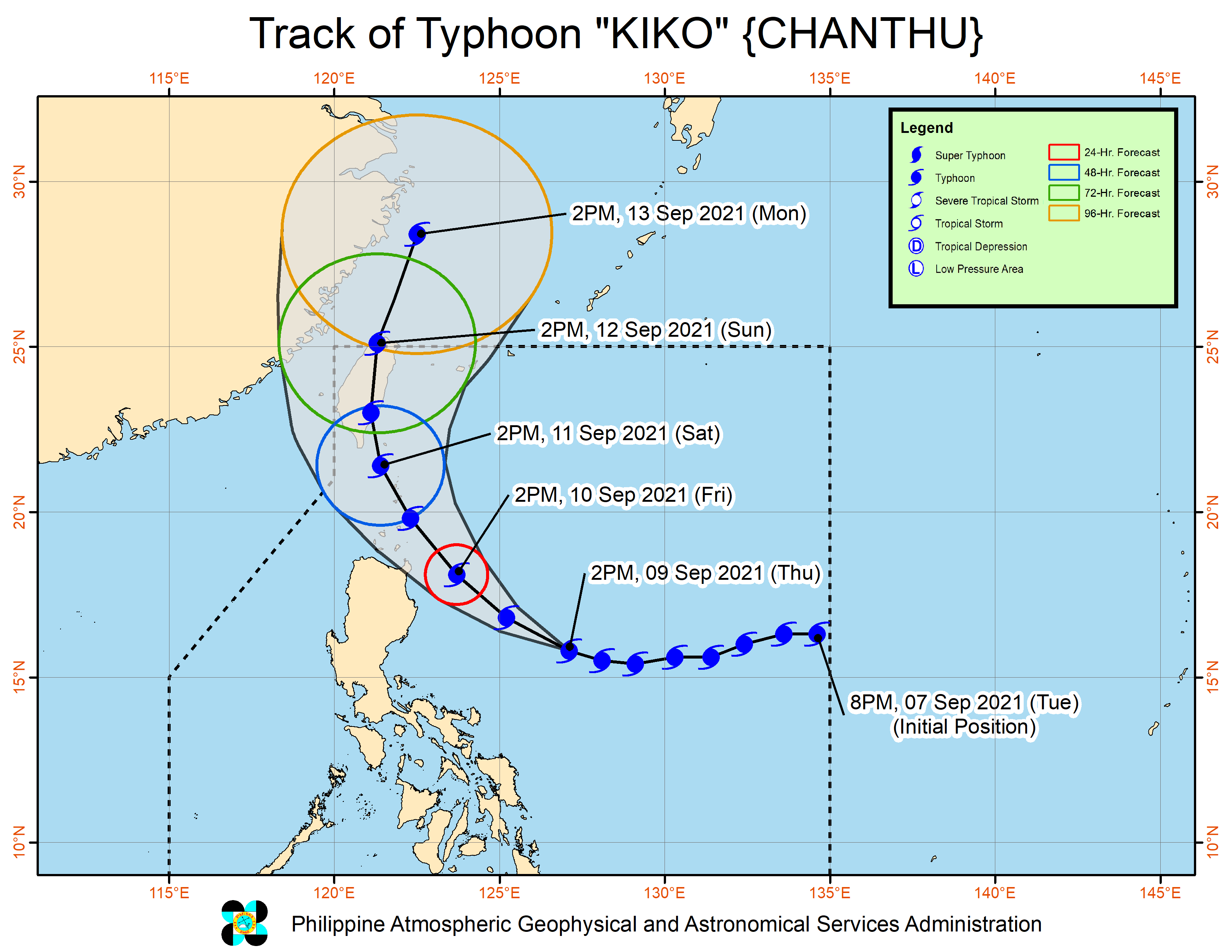
In a bulletin issued past 5 p.m., PAGASA said Kiko kept its peak winds of 195 kilometers per hour near the center and gusts of up to 240 kph. It is forecast to maintain its strength in the next 24 hours while passing close to mainland northern Luzon.
The typhoon was last located 550 km east of Baler, Aurora, heading west northwest at 20 kph.
PAGASA hoisted Signal No. 1 over the following areas:
- Batanes
- Cagayan including Babuyan Islands
- Northeastern portion of Apayao (Luna, Pudtol, Flora, Sana Marcela)
- Northeastern portion of Isabela (Santa Maria, San Pablo, Maconacon, Divilacan, Palanan)
Signal No. 1 indicates that strong winds with occasional gusts will be expected within 36 hours.
Signal No. 4 remains the highest possible wind signal for Kiko, PAGASA said.
Heavy rainfall
Starting Friday afternoon, Kiko will bring heavy to intense with at times torrential rains to Cagayan including Babuyan Islands, Batanes and northern Isabela.
Meanwhile, moderate to heavy with at times intense rains may affect the rest of Isabela.
Weather forecasters warned that coastal inundation and storm surge of up to 2 meters may affect several coastal municipalities in Northern Luzon.
Kiko’s track
PAGASA said the typhoon will move west northwest in the next 12 hours before turning northwest until Saturday. There may be "periods of short-term wobbling in its movement."
Kiko is expected to pass "very close" to northeastern Cagayan and cross the vicinity of Babuyan Islands and Batanes between Friday afternoon and Saturday afternoon.
However, "the possibility of landfall over the northeastern portion of Cagayan is not yet ruled," the weather bureau said.
It is forecast to exit the Philippine Area of Responsibility by Sunday afternoon.
Forecast position
- Friday afternoon: 220 km east of Aparri, Cagayan
- Saturday afternoon: 80 km northwest of Itbayat, Batanes
- Sunday afternoon: 480 km north of Itbayat, Batanes
- Monday afternoon: 850 km north of extreme Northern Luzon
Jolina’s exit
Tropical Storm Jolina (Conson), meanwhile, continued to move over the West Philippines. It had maximum sustained winds of 85 kph and gusts of up to 105 kph.
Jolina was last seen 410 km west of Dagupan City in Pangasinan.
PAGASA said that light to moderate with at times heavy rains may be experienced in Palawan, Western Visayas and Zamboanga Peninsula.
The cyclone is expected to leave the PAR within the day. — Gaea Katreena Cabico


- Latest
- Trending