‘Vicky’ threatens Palawan after dumping rains on Mindanao
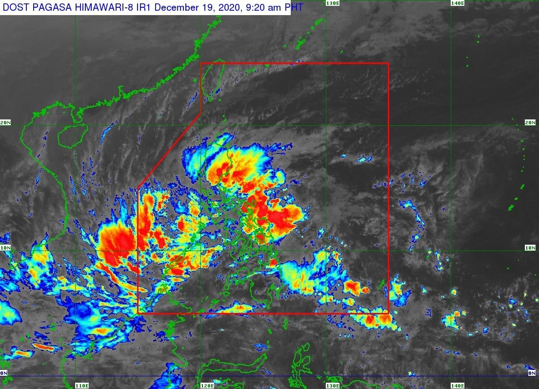
MANILA, Philippines (Updated 12:04 p.m.) — After dumping rain and causing massive flooding in parts of Mindanao, Tropical Depression Vicky is aiming for Palawan, with PAGASA forecasting that the storm will hit the northern or central portion of the island Saturday evening.
The state weather bureau said in its latest bulletin that Vicky is packing winds of 45 kilometers per hour and gusts of up to 55 kph.
It is warning that the storm will be bringing moderate to heavy with at times intense rains over the Calabarzon region, Bicol region, eastern Visayas, Isabela, Aurora, Marinduque, and the northern and central portions of Palawan including Calamian, Cuyo and Cagayancillo Islands.
Meanwhile, it is forecast to bring light to moderate with at times heavy rains over Apayao, Kalinga, Mountain Province, Ifugao, Metro Manila, Dinagat Islands, Surigao del Norte, Surigao del Sur, Agusan del Norte, Camiguin, Misamis Oriental, and the rest of mainland Cagayan Valley, Central Luzon, Mimaropa, Cordillera Administrative Region and Visayas.
Several areas in Palawan remain under Signal Number 1, where winds of 30 to 60 kph or intermittent rains may be expected in at least 36 hours. These areas are the following:
- Araceli, Palawan
- Dumaran, Palawan
- Taytay, Palawan
- El Nido, Palawan
- San Vicente, Palawan
- Roxas, Palawan
- Puerto Princesa City, Palawan
- Aborlan, Palawan
- Narra, Palawan
- Quezon, Palawan
- Sofronio Espanola, Palawan
- Calamian Islands
- Cuyo Island
- Cagayancillo Islands
- Kalayaan Islands
Heavy to intense rains are expected Sunday over Bicol Region, Quezon, Aurora, Isabela, Quirino and Nueva Vizcaya.
PAGASA said light to moderate with at times heavy rains will prevail over Metro Manila, Eastern Visayas, Bulacan, Dinagat Islands, and the rest of Cordillera Administrative Region, Calabarzon and Mimaropa.
#MindanaoNeedsHelp
Calls for help for Mindanao inundated social media on Saturday as photos and videos of flooding in some parts of the island group emerged.
Photos from Agusan del Sur show the waters almost reaching the tops of the houses.
PRAY FOR AGUSAN DEL SUR. Kuha ang mga larawan around 3:30pm ngayon at pataas pa ng pataas ang tubig at dumidilim na rin. Kailangan daw po nila ng rescue. #PrayfroAgusanDelSur #AgusandelSur
Posted by Anthony Magquilat on Friday, December 18, 2020
PAGASA previously hoisted a red rainfall warning over Agusan del Sur, Agusan Del Norte, Surigao del Sur, Surigao del Norte and Camiguin, telling residents there to be on alert for severe flooding and landslides.
Forecast positions:
- 24 hour (Sunday morning): 245 km east southeast of Kalayaan, Palawan
- 48 hour (Monday morning):225 km south southwest of Kalayaan, Palawan (outside PAR)
- 72 hour (Tuesday morning): 515 km southwest of Kalayaan, Palawan (outside PAR)
— Xave Gregorio


- Latest
- Trending