PAGASA: Rains seen over Visayas, Mindanao due to LPA
MANILA, Philippines — Weather bureau PAGASA on Thursday said a new low pressure area inside the country will bring rains to Visayas and Mindanao but has a small chance of developing into a typhoon.
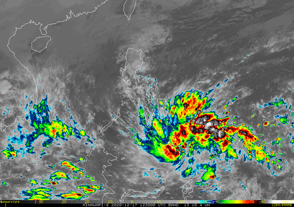
The agency in its afternoon forecast said the LPA which entered the Philippine Area of Responsibility Wednesday was last seen at 385 kilometers east southeast of Davao City.
It is seen to bring rains over Mindanao as well as Eastern and Central Visayas beginning tonight. PAGASA said that while it has a small chance of intensifying into a typhoon, it is not dismissing the possibility of the LPA becoming a tropical depression.
The weather disturbance is seen to either develop into a tropical depression after passing through Mindanao area and approaching Sulu Sea or when it goes through Palawan and move further to exit the country.
Weather specialist Raymond Ordinario explained that storms usually thread over the southern parts of the country at this time of the year due to the northeast monsoon or the amihan affecting Luzon.
Slight rains seen over Metro Manila earlier Thursday were also attributed to the amihan, which will also bring cloudy skies and scattered rains and thunderstorms over northern Luzon Friday.
The rest of Luzon, including NCR, will in turn experience a generally fair weather apart from isolated rains.
Visayas and Mindanao, meanwhile, will be generally cloudy and see rains and thunderstorms still due to the LPA.
PAGASA has said that one to two more storms may enter the Philippines this December to cap off 2020.
The country has seen 21 of it this year, with the last -- Typhoon Ulysses (international name Vamco), being the worst to hit, leaving over a hundred dead and billions in cost of damage.
Above normal rainfall conditions are also expected until March of next year due to the onset of the La Niña which PAGASA declared in October.
RELATED: La Niña amid pandemic: What local governments, communities can do to prepare
Gale warning has been raised over the following areas as of December 17, with the weather bureau warning that wave height could reach between 2.8 to 4.5 meters:
- Batanes
- Cagayan
- Isabela
- Aurora
- Eastern coast of Quezon
- Polilio Island
- Camarines provinces
- Eastern coast of albay
- Eastern coast of sorsogon
- Northern and eastern coast of northern samar
- Eastern coast of eastern samar and leyte
- Surigao del sur
- Surigao del norte
- Siargao
- Davao oriental
- Ilocos norte
- Ilocos sur
- La union
- Pangasinan
— Christian Deiparine


- Latest
- Trending