Signal No. 1 up over Cagayan, Babuyan Islands with 'Siony' now a severe tropical storm
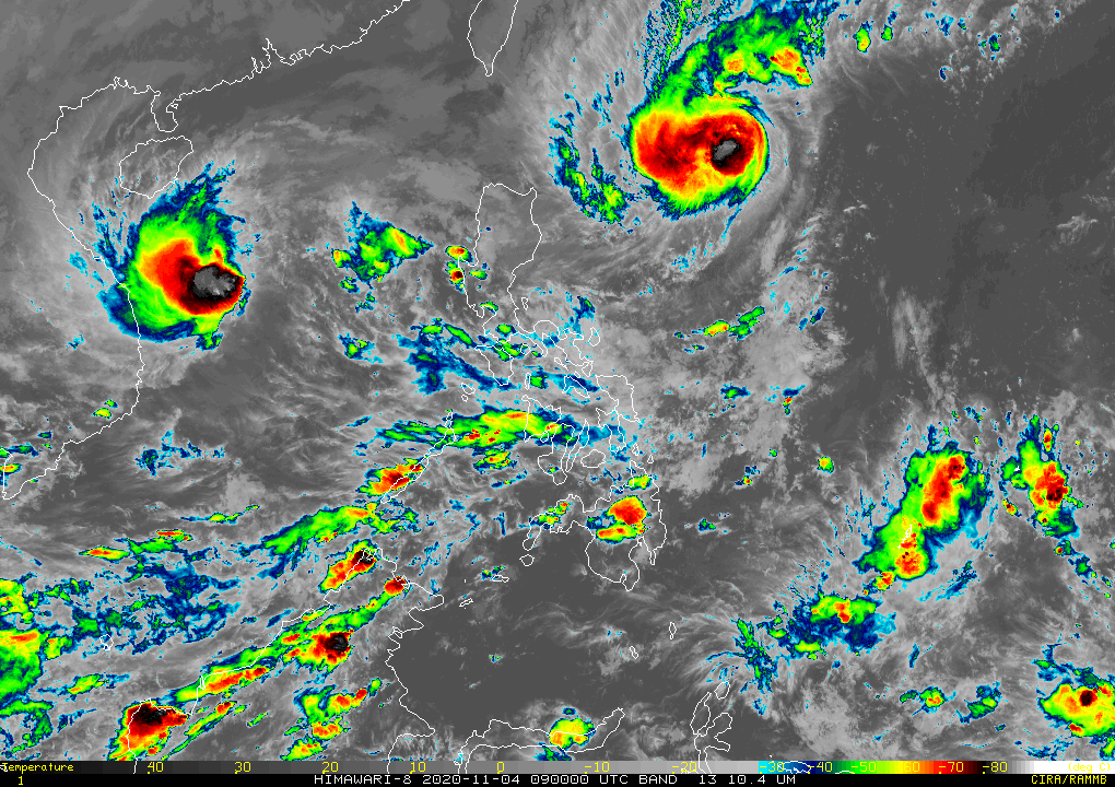
MANILA, Philippines — PAGASA on Wednesday said Tropical Storm Siony has intensified into a severe tropical storm with a landfall still possible despite forecasts that it will leave the country by November 6.
In its latest weather bulletin, the agency said "Siony" was last seen at 735 kilometers east of Basco in Batanes as it moves northward slowly.
It now carries 95 kilometers per hour maximum sustained winds and gusts of up to 115 kph, but could still intensify into a typhoon and may reach its peak of 125 kph.
PAGASA said the chances of "Siony" making landfall over Batanes and Babuyan Islands remain likely, with strong winds in the next 24 hours in the said areas due to the northeasterlies enhanced by "Siony" and Tropical Storm Rolly.
"Siony"'s extension as well as the northeasterlies is seen to bring light to moderate with ocassional heavy rains over Bicol Region, Aurora, Quezon — areas badly hit by Rolly as a super typhoon — as well as Cagayan and Isabela.
"Siony" is the 19th storm to hit the Philippines this year which is experiencing the onset of the La Niña, where PAGASA said above normal rainfall conditions as well as five to eight tropical cyclones may be expected until March 2021.
The following areas have been placed under Signal No. 1 as of the afternoon of Wednesday, November 4:
- northeastern portion of mainland Cagayan (Santa Ana, Gonzaga)
- eastern portion of Babuyan Islands (Balintang Island, Babuyan Island, Camiguin Island including their adjoining islets)
The combined effects of Rolly, Siony and the northeasterlies will also bring rough to very rough seas reaching between 2.8 to 5 meters over the seaboard of northern Luzon, northern seaboard of Camarines Sur, northern and eastern seaboards of Catanduanes, as well as those of Aurora, Camarines Norte, Kalayaan Islands and northern Quezon.
Central Luzon's western seaboard, the eastern and western seaboards of southern Luzon and eastern seaboards of Visayas and Mindanao, meanwhile, will see moderate to rough seas of wave height seen at 1.5 to 2.5 meters.
Forecast Positions
- Thursday afternoon: 405 km East of Calayan, Cagayan
- Friday afternoon: 195 km West of Basco, Batanes
- Saturday afternoon: 655 km West of Basco, Batanes
- Sunday afternoon: 1,050 km West of Northern Luzon — Christian Deiparine


- Latest
- Trending