Signal No. 1 over Metro Manila, parts of Luzon as 'Rolly' crosses West Philippine Sea
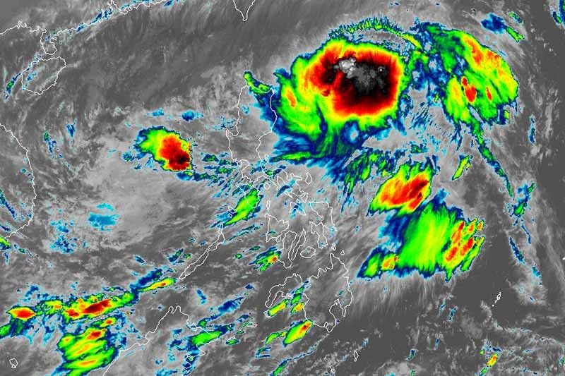
MANILA, Philippines — State weather bureau PAGASA warned of rough sea conditions in various parts of the country as Tropical Storm Rolly (international name: Goni) traverses West Philippine Sea after leaving a trail of destruction in Southern Luzon.
The world’s strongest storm yet this year battered the southern end of Luzon Sunday with destructive winds and intense rainfall, blowing off roofs, knocking down power lines and trees, and triggering flashfloods and mudflows.
At least 10 people were reportedly killed during Rolly’s onslaught in the country.
Rolly was last seen 100 kilometers west southwest of Subic Bay packing sustained winds of 65 kph and gusts of up to 80 kph. Moving west northwest at 20 kph, Rolly is expected to leave the Philippine Area of Responsibility Tuesday morning.
Tropical Cyclone Wind Signal No. 1 has been hoisted over the following areas:
- Northwestern portion of Occidental Mindoro (Paluan, Mamburao, Abra de Ilog) including Lubang Island,
- Western portion of Batangas (Tingloy, Mabini, Bauan, San Luis, Taal, Agoncillo, San Nicolas, Santa Teresita, Talisay, Laurel, Lemery, Calaca, Balayan, Calatagan, Tuy, Lian, Nasugbu)
- Extreme western portion of Laguna (San Pedro City, Biñan City)
- Cavite
- Metro Manila
- Western portion of Bulacan (San Jose del Monte City, Santa Maria, Pandi, Bustos, Baliuag, Marilao, Meycauayan City, Obando, Bocaue, Bulacan, Balagtas, Guiguinto, Pulilan, Plaridel, Malolos City, Paombong, Hagonoy, Calumpit)
- Western portion of Pampanga (San Luis, Mexico, Masantol, Sasmuan, Floridablanca, Lubao, Porac, Guagua, Santa Rita, Bacolor, Angeles City, Santo Tomas, San Fernando City, San Simon, Macabebe, Minalin, Apalit)
- Bataan
- Southern portion of Zambales (San Marcelino, San Felipe, San Narciso, San Antonio, Castillejos, Subic, Olongapo City).
PAGASA said strong breeze to near gale conditions with occasional gusts will be experienced in areas under TCWS No. 1, Batanes, Babuyan Islands, Ilocos region, Cordillera Administrative Region and the northern portions of mainland Cagayan and Zambales.
Sea travel, especially for those with small sea vessels, is risky over the seaboards of northern and central Luzon, western seaboards of Batangas, Occidental Mindoro including Burias Island and Calamian Islands, and eastern seaboards of Quezon including Polillo Islands and Bicol region due to rough to very rough seas.
Meanwhile, moderate to rough seas will prevail over the western seaboards of Palawan including Kalayaan Islands and eastern seaboards of Visayas and Mindanao.
PAGASA said Rolly will likely weaken into a tropical depression due to “increasingly unfavorable conditions.”
‘Siony’
As Rolly leaves the Philippine landmass, weather forecasters are also monitoring another tropical cyclone—Tropical Storm Siony (international name: Atsani).
Siony was last located 850 km east of northern Luzon with peak winds of 65 kph and gusts of 80 kph.
PAGASA said the tropical storm remains “less likely” to directly affect the weather and coastal conditions in the country over the next two to three days.
The center of Siony is expected to continue moving west northwest until Monday evening before it slows down significantly and becomes almost stationary until Tuesday evening. Then, it will begin tracking west southwestard or westward toward extreme Northern Luzon.
“Due to the projected erratic movement of this system in the next 48 hours, there is high degree of uncertainty in the forecast track,” PAGASA said.
Siony is forecast to remain in the tropical storm category within the next 36 to 48 hours but it may intensify to a severe tropical storm during the period when it becomes almost stationary.
Forecast positions of 'Rolly'
- Tuesday morning: 540 km west of Subic Bay
- Wednesday morning: 805 km west of Central Luzon (outside PAR)
Forecast positions of 'Siony'
- Monday evening: 770 km east of Aparri, Cagayan
- Tuesday evening: 780 km east of Aparri, Cagayan
- Wednesday evening 415 km east of Aparri, Cagayan
- Thursday evening: 85 km west northwest of Laoag City, Ilocos Norte
- Friday evening: 670 km west of Calayan, Cagayan (outside PAR)
— Gaea Katreena Cabico


- Latest
- Trending