'Quinta' seen to exit PAR on Tuesday, but new LPA sighted
MANILA, Philippines — Typhoon Quinta (international name Molave) has slightly intensified before it exits the Philippine Area of Responsibility on Tuesday morning, but PAGASA said a new low pressure area could also enter the country this week.
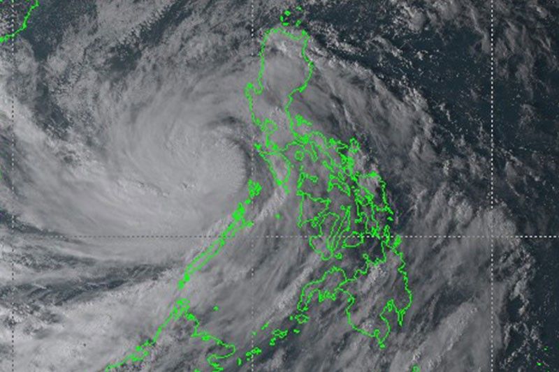
The weather bureau in its 5 p.m. bulletin said the eye of Quinta was last spotted at 310 km west of Calapan City in Oriental Mindoro, with a speed of 25 kph.
Currently, it has a maximum sustained winds of about 130 kph near the center and gustiness of up to 160 kph.
Disaster officials by Monday noon reported some 2,450 families or 9,123 persons affected so far across Bicol Region and the Cordillera Administrative Region.
Of the said figures, 1,478 families or 5,603 individuals are currently in evacuation centers, while 958 families or 3,471 persons are outside emergency shelters.
PAGASA said Quinta will continue to bring moderate to heavy with occasional intense rains over Occidental Mindoro, Oriental Mindoro, northern Palawan including Calamian and Cuyo Island, as well as in CALABARZON, Aurora and Isabela.
The same will be experienced over Cagayan, Apayao, Kalinga, Abra, Ilocos Norte and Ilocos Sur due to the tail-end of a frontal system.
Metro Manila, meanwhile, along with Western Visayas, Zamboanga Peninsula, Bangsamoro and the rest of Luzon will see light to moderate with at times heavy rains.
As of Monday afternoon, Signal No. 3 and 2 have been lifted in various areas, with Signal No. 1 remaining in these provinces:
- Batangas
- Occidental Mindoro including Lubang Island, Oriental Mindoro
- Calamian Islands
- extreme northern portion of Antique (Caluya)
Officials have also yet to release figures on the estimated amount of damage incurred from Quinta's wrath in the country.
New LPA sighted
PAGASA said the new weather disturbance was seen at 1,945 km east of Southern Luzon at 4 p.m. of Monday afternoon.
The LPA, forecasters said, could enter the country by Wednesday or Thursday morning, but that "it is less likely to develop into tropical depression" in the next 48 hours.
It would be the 18th storm that will hit the Philippines this year, which follows through with PAGASA's announcement of the La Niña from October 2020 to until March of 2021, where above normal rainfall conditions will be experienced.
Forecast Positions
- Tuesday afternoon: 835 km West of Tanauan City, Batangas
- Wednesday afternoon: 1,230 km West of Central Luzon
???????— Christian Deiparine


- Latest
- Trending