Signal No. 1 up in parts of Isabela, Aurora due to ‘Pepito’
MANILA, Philippines — Weather forecasters placed parts of Isabela and Aurora under Tropical Cyclone Wind Signal No. 1 Monday morning as Tropical Depression Pepito as moves toward Luzon.
TCWS No. 1 has been raised over the following areas:
- Eastern portion of Isabela (Palanan, Dinapigue, eastern portion of San Mariano)
- Northern portion of Aurora (Dinalungan, Casiguran, Dilasag)
PAGASA said areas under TCWS No. 1 may experience occasional gusts in the next 36 hours. TCWS No. 1 may be also hoisted over the eastern portion of Quirino and other municipalities in Isabela and Aurora in the next bulletin to be issued at 5 p.m.
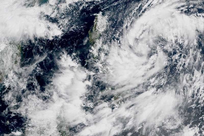
“Pepito” was last seen 475 kilometers east of Virac, Catanduanes packing peak winds of 45 km per hour and gusts of up to 55 kph. It is heading west at 30 kph.
The state weather bureau said the tropical depression will move west northwestward or northwestward Monday then turn westward Tuesday toward the Northen Luzon-Central Luzon area.
“Pepito” is expected to make landfall over the eastern coast of Northern Luzon-Central Luzon area between Tuesday evening and Wednesday early morning.
It is also forecast to strengthen into a tropical storm before it crashes into land. After crossing the Luzon landmass, “Pepito” may further intensify over the West Philippine Sea and may reach severe tropical storm category by Thursday.
Hazards affecting land, coastal waters
Light to moderate with at times heavy rains may be experienced over the following areas:
- Quezon
- Bicol region
- Eastern Visayas
- Zamboanga Peninsula
- Bangsamoro
- Caraga
- Davao Oriental
- Davao Occidental
- Sultan Kudarat
- South Cotabato
- Sarangani
The northeasterly surface windflow enhanced by “Pepito” may bring strong-force to near gale-force winds with occasional gusts over:
- Batanes
- Babuyan Islands
- Mountainous areas of northern Ilocos Norte, Apayao, Cagayan, Isabela, Aurora, Quezon, Camarines Norte, Camarines Sur, Albay, Sorsogon and Northern Samar
Gale warning is in effect over the seaboards of Batanes, Cagayan, Ilocos Norte, Ilocos Sur and Isabela due to rough to very rough seas caused by the northeasterly surface windflow. Sea travel is risky over these areas, especially for those using small sea vessels.
Meanwhile, moderate to rough seas due to “Pepito” and the northeasterly surface windflow will be experienced in the next 24 hours over the eastern seaboards of Central Luzon and Bicol region and the seaboards of Northern Samar and Eastern Samar.
Forecast positions
- Tuesday morning: 370 km east of Baler, Aurora
- Wednesday morning: 95 km west northwest of Dagupan City, Pangasinan
- Thursday morning: 445 km west of Dagupan City, Pangasinan (outside PAR)
- Friday morning: 710 km west of Dagupan City, Pangasinan (outside PAR)
- Saturday morning: 980 km west of northern Luzon (outside PAR)
— Gaea Katreena Cabico


- Latest
- Trending