Tropical Depression Ferdie exits PAR
MANILA, Philippines — Tropical Depression Ferdie has left the Philippine Area of Responsibility but rains will continue to drench parts of Luzon, state weather bureau PAGASA said.
“Ferdie”—the sixth tropical cyclone to affect the country this year—left PAR at 9 a.m.
It was last seen 265 kilometers west northwest of Laoag City in Ilocos Norte or 315 west of Calayan in Cagayan with peak winds of 55 km per hour near the center and gusts of up to 70 kph.
It is moving north over the West Philippine Sea.
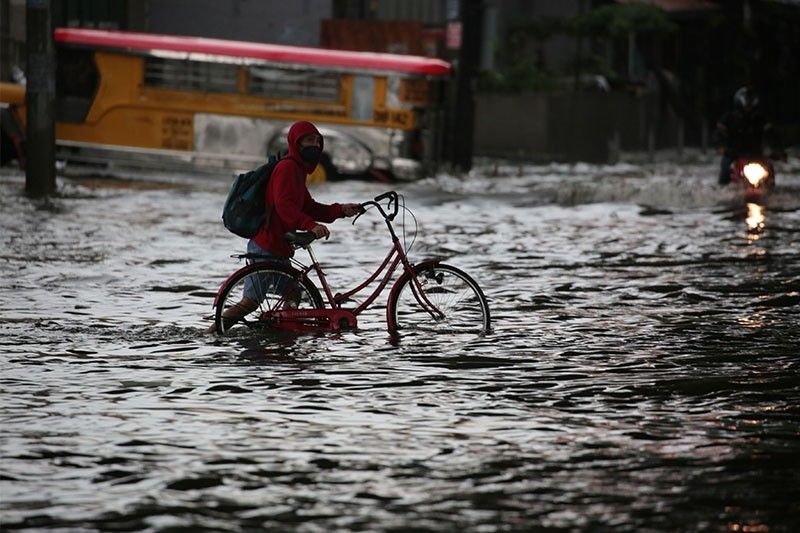
Storm warning signals were lifted after the tropical depression’s exit from the country’s jurisdiction. It, however, will enhanced the southwest monsoon or habagat, which will bring monsoon rains over Ilocos region, Abra, Benguet, Zambales and Bataan.
Occasional rains will also drench Metro Manila, Calabarzon, Mimaropa and the rest of Cordillera Administrative Region and Central Luzon.
Residents of these areas should monitor possible flooding and rain-induced landslides during heavy or prolonged rainfall.
“Ferdie” developed into a tropical depression Sunday night hours after Tropical Storm Enteng (Jangmi) left PAR.
PAGASA declared the start of rainy season in June. — Gaea Katreena Cabico

Follow this thread for updates on Tropical Depression Ferdie.
Photo: RAMMB
Tropical Depression Ferdie has exited the Philippine area of responsibility, state weather bureau PAGASA says.
The weather disturbance is forecast to move generally northward over the West Philippine Sea and make landfall over Fujian province in China Tuesday morning.
At 10 a.m., it was located 265 kilometers west northwest of Laoag City, Ilocos Norte or 315 kilometers west of Calayan, Cagayan. It packs maximum sustained winds of 55kph and gusts of up to 70 kph.
The western portions of Ilocos Norte and Ilocos Sur are under Tropical Cyclone Wind Signal No. 1 as Tropical Depression Ferdie approaches the northwestern border of the Philippine area of responsibility.
The weather disturbance is forecast to reach tropical storm category by Monday night or Tuesday morning and weaken into a low pressure area Tuesday evening after landfall.
At 4 a.m., Ferdie was located 210 kilometers west northwest of Sinait, Ilocos Sur or 210 kilometers west of Laoag City, Ilocos Norte.


- Latest
- Trending