Batanes only area under Signal No. 1 due to ‘Carina’
MANILA, Philippines — Tropical Depression Carina may weaken into a low pressure area between Tuesday and Wednesday morning but it will still dampen parts of Northern Luzon, weather forecasters said.
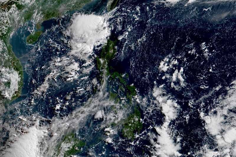
The center of “Carina” was last seen 95 kilometers west northwest of Basco, Batanes packing maximum sustained winds of 45 km per hour and gusts of up to 55 kph. It is heading northwest at 25 kph.
PAGASA said the tropical depression is expected to turn northward while approaching the Bashi Channel and the southern portion of Taiwan.
Only Batanes is placed under Tropical Cyclone Wind Signal No. 1. Residents of the province will experience winds between 30 and 60 kph or intermittent rains within 36 hours.
“Carina” will bring scattered light to moderate rains with at times heavy rainshowers over Batanes, Babuyan Islands and Ilocos Norte.
Meanwhile, Metro Manila and the rest of the country will have partly cloudy to cloudy skies with isolated rainshowers.
PAGASA also advised those with small seacrafts not to venture out over the seaboards of Northern Luzon due to moderate to rough seas.
Forecast position
- Wednesday morning: 325 km north northwest of Basco, Batanes
— Gaea Katreena Cabico

Tropical Depression Carina — the third tropical cyclone to enter the country this year — maintains its strength as it moves over Luzon Strait, state weather bureau PAGASA says.
At 7 a.m., the weather disturbance was located 275 kilometers east of Tuguegarao City with maximum sustained winds of 45 kph and gusts of up to 55 kph.
It is forecast to weaken into a low pressure area by Wednesday.
Tropical Depression Carina continues to move away from Batanes as it heads towards Bashi Channel and the southern portion of Taiwan, PAGASA says.
At 10 a.m., the typhoon was located 155 west of Basco, Batanes with maximum winds of 45 kph and gusts of up to 55 kph. It is moving northwestward at 25 kph.
Tropical Cyclone Wind Signal no. 1 is still hoisted over Batanes.
Tropical Cyclone Wind Signal no. 1 is still raised over Batanes as Tropical Depression Carina moves past the Balintang Channel.
State weather bureau PAGASA says Carina is now approaching the Bashi Channel.
At 7 a.m., the typhoon was located 95 kilometers west northwest of Basco, Batanes. It packs maximum winds of 45 kph and gusts of up to 55 kph. It is moving northwestward at 25 kph.
Tropical Depression Carina maintains its strength as it moves towards the Luzon Strait. It is forecast to weaken into a low pressure area by Wednesday.
At 4 p.m., the tropical depression was located 165 kilometers east northeast of Tuguegarao City, Cagayan. The weather disturbance packs winds of 45 kph and gusts of up to 55 kph. It is moving northwestward at 15 kph.
Tropical cyclone wind signal no. 1 is still raised over Batanes Babuyan Islands and the northeastern portion of mainland Cagayan (Santa Ana, Gonzaga, Santa Teresita, Buguey, Camalaniugan, Aparri, Lal-lo, Gattaran and Baggao).
Tropical Depression Carina continues to approach extreme northern Luzon, passing near Babuyan Islands and Batanes.
At 10 a.m., the typhoon was located 245 kilometers east of Tuguegarao City, Cagayan, packing maximum sustained winds of 45 kph near the center and gustiness of up to 55 kph.
Tropical Cyclone Wind Signal no. 1 is raised over Batanes, Babuyan Islands and the northeastern portion of mainland Cagayan (Santa Ana, Gonzaga, Santa Teresita, Buguey, eastern Lal-lo, eastern Gattaran and eastern Baggao).


- Latest
- Trending