Maps of areas in immediate danger from a hazardous Taal eruption
Maps released by state volcanologists show the extent of possible hazards that accompany a dangerous eruption of Taal Volcano in Batangas that may occur anytime following PHIVOLCS' raising of Alert Level 4 on Sunday.
The looming hazardous eruption that may originate anywhere within the volcano island may involve "flows of ashes, rocks, gas at speeds of more than 60 kph horizontally," as top state seismologist Renato Solidum explained.
The maps can also be generated using an online tool under the Department of Science and Technology. They mark zones that may be immediately affected by at least three volcanic hazards. They also show areas within the 14-kilometer radius from the volcano's crater where residents were forced to evacuate.
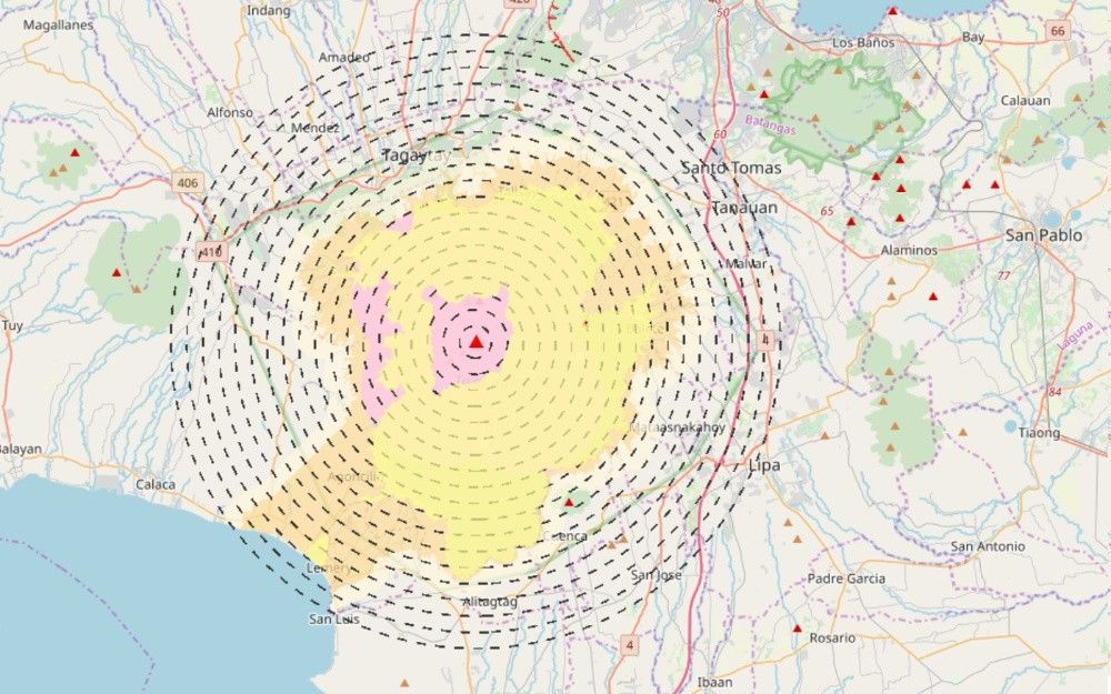
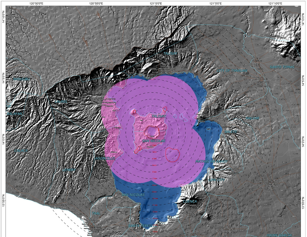
Volcanic tsunami
Taal's eruption can trigger explosions and shock waves underwater that may then push large amounts of water surrounding the volcano to the shoreline.
The PHIVOLCS map also shows the area (in yellow) where the ground can crack from the fissuring and oscillation.
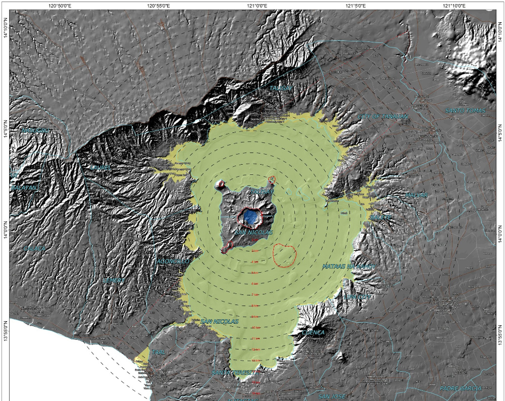
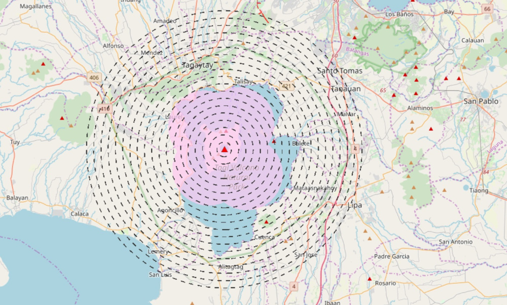
Base surge
This shows the possible reach of dangerous, turbulent cloud of hot gases and debris, destroying whatever is in the way at high speed. This rushing current involves a mix of hot lava, rocks, ash, volcanic gas and pumice moving down the volcanic slope.
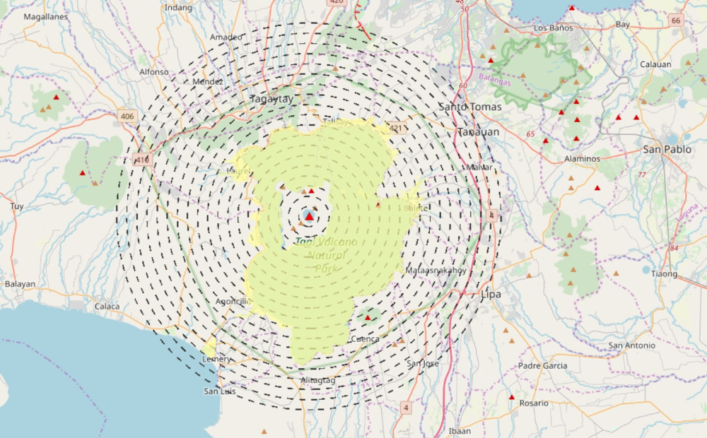
The feared hazardous eruption may occur through any of the five vents, namely Taal Volcano Island Main Crater, Binintiang Malaki, Pirapiraso, Off-Calauit and Binintiang Munti.
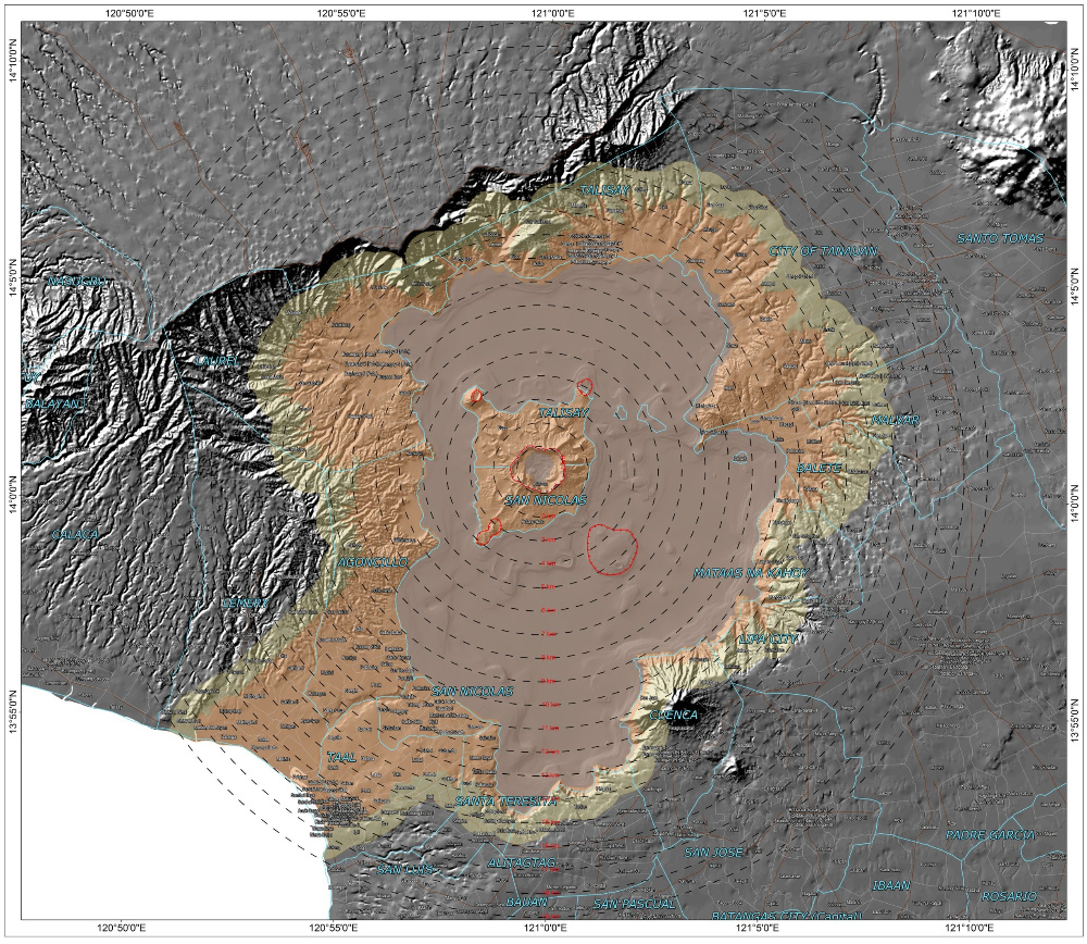
The estimates shown in the map are based on the reconstruction of events in 1754, the greatest recorded explosion of the volcano and which lasted seven months. This is considered the worst-case scenario today.
ALSO READ: Best- and worst-case scenarios: Taal eruption may last from days to months
The orange marker covers zones prone to base surge while the yellow market indicates the buffer zone, which is one kilometer from the base surge zone.
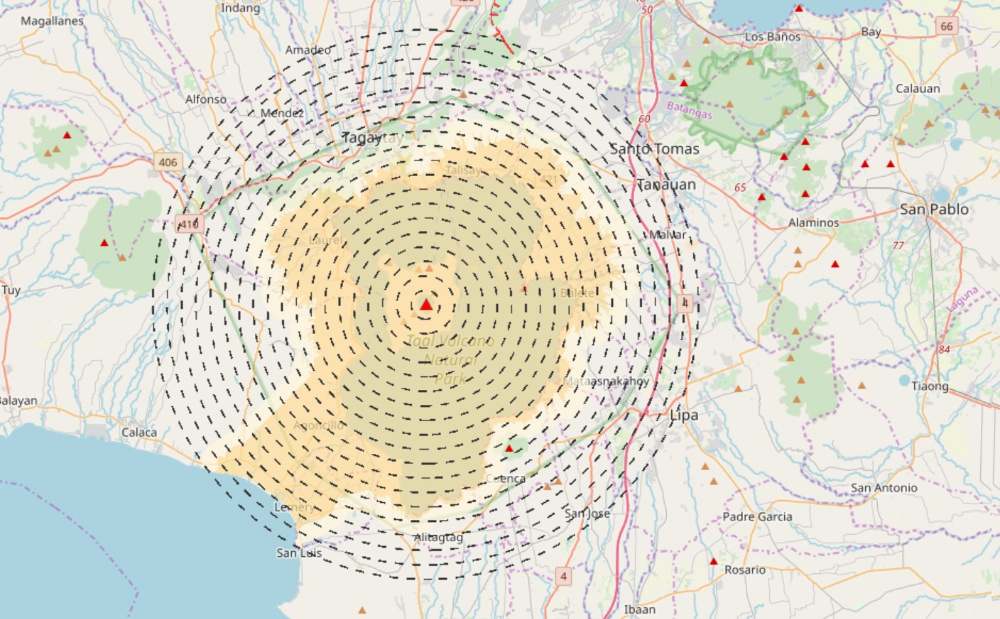
Ballistic projectiles
Areas within the zones are susceptible to the forceful ejection of volcanic materials such as hot rocks and falling fragments from the volcano's vent.
The blocks are hurled as forcefully as cannonballs and may fall 2-5 kilometers from the vent. — Camille Diola


- Latest
- Trending