Pagasa: Tisoy slams into Bicol tonight
MANILA, Philippines — The Philippine Atmospheric, Geophysical and Astronomical Services Administration (PAGASA) warned of possible disruptions of some events in the ongoing 30th Southeast Asian Games in the country due to Typhoon Tisoy (international name Kammuri), which was forecast to slam into Bicol tonight.
“We’re giving (SEA Games officials) the necessary data like how much rainfall (Tisoy) could bring. Definitely the SEA Games will be affected, especially Clark, on Tuesday,” PAGASA deputy administrator Landrico Dalida Jr. said in a press conference yesterday.
The 30th SEA Games is being held in Metro Manila; Subic, Zambales; Clark, Pampanga and other parts of Southern and Central Luzon.
Metro Manila was among the areas under tropical cyclone wind signal No. 1 as of 5 p.m. yesterday.
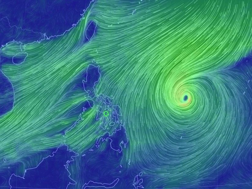
Tisoy is expected to make landfall over Catanduanes tonight and cross the entire Bicol and Calabarzon (Cavite, Laguna, Batangas, Rizal, Quezon) regions, according to PAGASA weather specialist Benison Estareja.
Dalida said today and tomorrow are the critical days, when Tisoy was projected to barrel through Luzon. PAGASA warned of strong winds and continuous heavy to intense rain over Bicol.
Tropical cyclone wind signal No. 2 was raised over Camarines Sur, Catanduanes, Albay, Sorsogon, Northern Samar, Eastern Samar and Samar as of 5 p.m.
Occasional to frequent heavy rains will also affect Samar provinces and Biliran, while moderate to occasional heavy rains will prevail over Romblon, Marinduque and Quezon.
The state weather bureau also warned against possible storm surges of more than three meters in Catanduanes, Camarines Norte and Camarines Sur, and up to three meters in Quezon, Camarines Norte, Albay, Quezon and Sorsogon.
Apart from Metro Manila, other areas placed under signal No. 1 were over Aurora, eastern portion of Nueva Ecija (Cabanatuan City, Cabiao, Gabaldon, Gapan City, General Mamerto, Natividad, General Tinio, Jaen, Laur, Pantabangan, Peñaranda, Rizal, San Antonio, San Isidro, San Leonardo and Santa Rosa); Rizal; Bulacan; Laguna; Cavite; Batangas; Oriental Mindoro; Quezon, including Polillo Islands; Camarines Norte; Masbate, including Burias and Ticao Island; Marinduque and Romblon.
Signal No. 1 was also hoisted over Aklan; Capiz; Antique; Iloilo; Guimaras; northern portion of Negros Occidental (Bacolod City, Bago City, Cadiz City, Calatrava, Enrique B. Magalona, Escalante City, La Carlota City, Manapla, Murcia, Pulupandan, Sagay City, Salvador Benedicto, San Carlos City, San Enrique, Silay City, Talisay City, Toboso, Valladolid and Victorias City); Northern and Metro Cebu; Biliran; Leyte; Southern Leyte; Dinagat Islands and Siargao Island.
Tomorrow morning until Wednesday morning, frequent to continuous heavy rains are expected over Metro Manila, Bicol region, Calabarzon, Central Luzon, Mindoro provinces, Marinduque and Romblon.
Light to moderate with occasional heavy rains will affect Aklan, Capiz, northern portion of Antique and the rest of Luzon.
PAGASA said Tisoy maintained its strength as it continued to move west toward Luzon at a speed of 20 kilometers per hour.
As of 4 p.m. yesterday, the eye of the typhoon was spotted at 595 kilometers east of Virac, Catanduanes, packing winds of 140 kilometers per hour near the center and gustiness of up to 170 kph.
Earlier yesterday, PAGASA weather division chief Esperanza Cayanan called on Filipinos living in high-risk areas to seek safer and higher ground ahead of Tisoy’s onslaught.
“We urge those who have big trees beside their houses to trim them, those who reside near creeks or river streams should evacuate as early as now and should not wait for the typhoon’s landfall,” Cayanan said.
She also urged outdoor advertisers in areas along the path of Tisoy to roll down their billboards and advised residents to prepare for possible power outages.
“We urge the public to charge their phones and store extra food,” she said.
Tisoy is forecast to exit the Philippine area of responsibility on Thursday. – With Evelyn Macairan


- Latest
- Trending