No ‘significant’ rains seen as ‘Sarah’ weakens, moves away
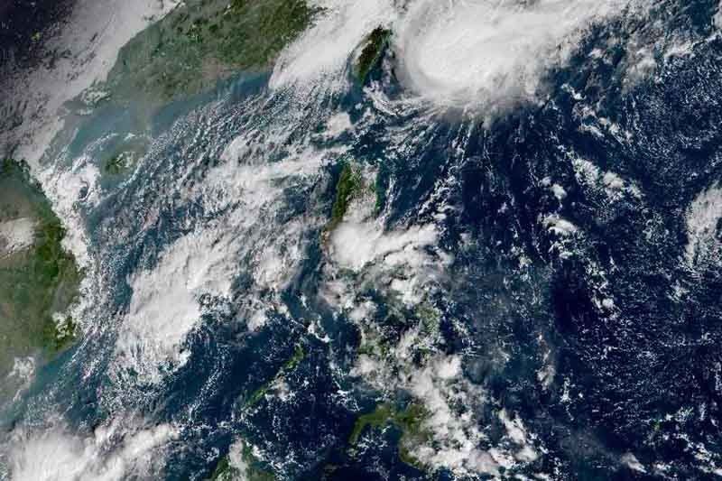
MANILA, Philippines — Severe Tropical Storm Sarah (Fung-wong)—which weakened before dawn—is no longer expected to bring significant rains over the country, weather forecasters said Friday.
The center of “Sarah” was seen 345 kilometers northeast of Basco, Batanes. It is moving north toward Japan’s Ryuku Islands at a slightly faster pace of 20 kph.
The weakened “Sarah” now packs maximum sustained winds of 95 kph from the previous 110 kph and gusts of up to 115 kph from the previous 135 kph.
Since the severe tropical storm is moving away, the Batanes is no longer under Tropical Cyclone Wind Signal No. 1.
PAGASA, however, said gusts may still be experienced over Batanes and Babuyan Islands due to the surge of the northeast monsoon or amihan. But the gusty condition is expected to “gradually” weaken throughout the day.
Sea travel remains risky over the seaboards of Batanes, Cagayan (including Babuyan Islands), Ilocos provinces and Isabela) due to rough sea conditions caused by amihan.
“Sarah” is seen to leave the Philippine Area of Responsibility between Friday evening and Saturday morning. It is expected to gradually weaken as it moves toward the East China Sea in two days.
The cyclone did not make a landfall over any part of the country but its trough or extension dumped rains to some parts of Luzon.
Forecast positions
- Saturday morning: 580 km north northeast of Basco, Batanes
- Sunday morning: 1,065 km north northeast of extreme Northern Luzon (outside PAR)
— Gaea Katreena Cabico


- Latest
- Trending