Tropical Storm Sarah accelerates as ‘Ramon’ weakens into LPA
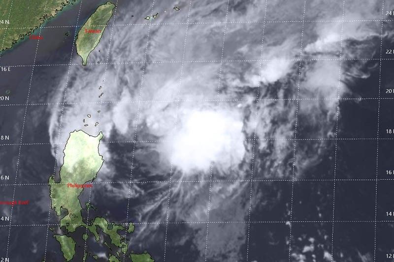
MANILA, Philippines — Tropical Storm Sarah (Fung-wong) has slightly gained speed while spiralling over the Philippine Sea, weather forecasters said late Wednesday afternoon.
Meanwhile, the tropical depression that was previously called “Ramon” weakened into a low pressure area as predicted.
“Sarah” was last seen 540 kilometers east of Tuguegarao City, Cagayan packing peak winds of 65 kph and gusts of up to 80 kph.
The tropical storm maintained its north northwest track but it is now moving at the speed of 30 kph from the previous 20 kph.
Tropical Cyclone Wind Signal No. 1 is raised over:
- Batanes
- Northeastern portion of Cagayan (Gattaran, Lal-lo, Buguey, Gonzaga, Sta. Ana, Babuyan Islands)
Weather specialist Benison Estareja said “Sarah” will grow into a severe tropical storm on Wednesday. But it will weaken into a tropical storm once it traverses the Cagayan-Batanes area.
“Sarah” may leave the Philippine Area of Responsibility on Saturday as a tropical depression.
Forecast positions
- Thursday afternoon: 230 km east of Aparri, Cagayan
- Friday afternoon: 70 km north of Calayan, Cagayan
- Saturday afternoon: 230 km west northwest of Basco, Batanes (outside PAR)
- Sunday afternoon: 410 km west northwest of Basco, Batanes (outside PAR)
From tropical depression to LPA
The tropical depression that was previously called “Ramon” was downgraded to LPA category at 2 p.m. PAGASA earlier said the weather disturbance will further weaken after making a landfall due to land interaction and the presence of northern monsoon or amihan.
The LPA was last spotted in the vicinity of Carranglan, Nueva Ecija.
It is expected to cross Central Luzon and leave the country’s landmass by Thursday.
Rainfall forecast
Those living in Batanes, Cagayan (including Babuyan Islands), Apayao and the northern portion of Ilocos Norte will experience light to moderate with occasional heavy rains tonight due to the interaction of the tropical storm and the LPA with amihan.
Meanwhile, the LPA will bring light to moderate with intermittent heavy rains over Ilocos Sur, Abra, Kalinga, Mt. Province, Ifugao, La Union, Benguet, Nueva Vizcaya and the rest of Ilocos Norte.
Strong to gale force winds are forecast to prevail over Batanes and Babuyan Islands, while occasional gusty conditions are expected to be experienced over the rest of Northern Luzon due to the surge of “amihan.”
By Thursday, “Sarah” will dump light to moderate with intermittent heavy rains over Batanes and Cagayan including Babuyan Islands. — Gaea Katreena Cabico


- Latest
- Trending