‘Ramon’ becomes severe tropical storm ahead of northern Cagayan landfall
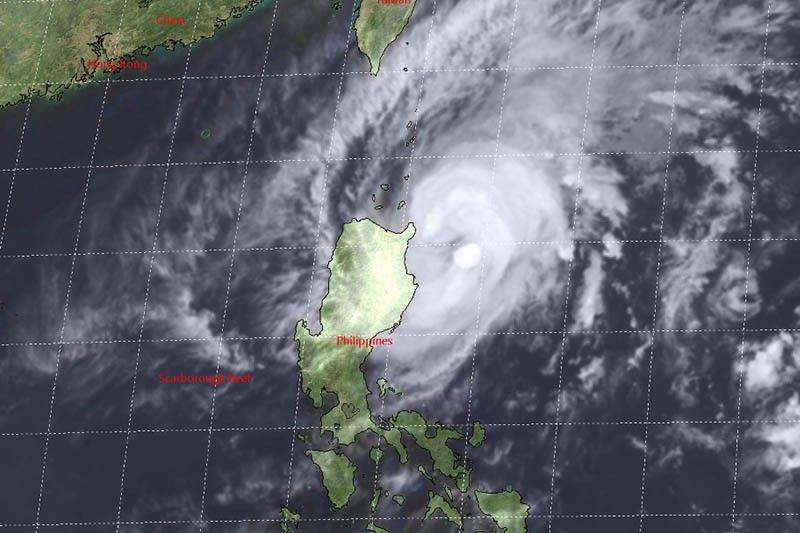
MANILA, Philippines — “Ramon” (Kalmaegi) has strengthened into a severe tropical storm Monday afternoon as it approaches northern Cagayan, state weather bureau PAGASA said.
At 4 p.m., “Ramon” was spotted 125 kilometers east of Aparri, Cagayan. Weather forecasters said it “now poses a threat to northern Cagayan.”
Its maximum sustained winds have intensified to 100 kph from the previous 85 kph, while its gusts have reached 125 kph from the previous 105 kph.
Heading north northwest at 10 kph, the severe tropical storm is forecast to make a landfall over northern Cagayan between Monday night and Tuesday morning.
Winds between 61 kph and 120 kph may be experienced within 24 hours over these areas under Tropical Cyclone Wind Signal No. 2:
- Cagayan (including Babuyan Islands)
- Northern portion of Isabela (Sta. Maria, San Pablo, Maconacon, Cabagan, Sto. Tomas, Quezon, Delfin Albano, Tumauini and Divilacan)
- Apayao
- Kalinga
- Ilocos Norte
TCWS No. 1, meanwhile, is hoisted over:
- Batanes
- Ilocos Sur
- Abra
- Mountain Province
- Benguet
- Ifugao
- La Union
- Northern Aurora (Dilasag, Casiguran and Dinalungan)
- Rest of Isabela
Winds between 30 kph and 60 kph are expected in these areas within 36 hours.
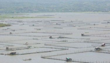
Sea travel remains dangerous over the seaboards of areas under TCWS, western seaboard of Northern Luzon and the eastern seaboards of Central and Southern Luzon.
Rainfall outlook
“Ramon” will bring moderate with occasional to frequent heavy rains over Cagayan (including Babuyan Islands), Batanes, northern portion of Isabela, Ilocos Norte and Apayao tonight.
Light to moderate with intermittent heavy rains, meanwhile, will affect the rest of Ilocos Norte, rest of Isabela, Kalinga, Abra and Ilocos Norte.
By Tuesday, those living in northern Cagayan (including Babuyan Islands, Batanes, Apayao and the northern portions of Ilocos Norte will have light to moderate with occasional heavy rains.
Meanwhile, light to moderate with intermittent heavy rains will be experienced over the rest of Ilocos Norte, Isabela, Kalinga, Abra, Ilocos Sur and the rest of Cagayan.
Forecast positions
- Tuesday afternoon: In the vicinity of Dona Loreta, Pudtol, Apayao
- Wednesday afternoon: 275 km west of Iba, Zambales
- Thursday afternoon: 10 km west of Pagasa Island, Palawan


- Latest
- Trending