Parts of Ilocos Norte now under Signal No. 2 as ‘Ramon’ churns toward land
MANILA, Philippines — The northern portions of Ilocos Norte have been added to the list of areas under Tropical Cyclone Wind Signal No. 2 as Tropical Storm Ramon (Kalmaegi) continues to move toward northern Cagayan.
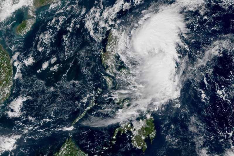
At 10 a.m., “Ramon” was spotted 160 kilometers east northeast of Tuguegarao City, Cagayan, maintaining its peak winds of 85 kph and gusts of up to 105 kph.
Heading west northwest at 10 kph, the tropical storm is forecast to hit northern Cagayan between Monday night and Tuesday morning.
PAGASA said that “Ramon” may grow into a severe tropical storm before landing in Cagayan.
Winds between 61 kph and 120 kph may be experienced within 24 hours over these areas under Signal No. 2:
- Cagayan (including Babuyan Islands)
- Northern portion of Isabela (Sta. Maria, San Pablo, Maconacon, Cabagan, Sto. Tomas, Quezon, Delfin Albano, Tumauini and Divilacan)
- Apayao
- Kalinga
- Northern portion of Ilocos Norte (Pagudpud, Burgos, Bangui, Dumalneg and Adams)
Meanwhile, Signal No. 1 has been raised over:
- Batanes
- Rest of Ilocos Norte
- Ilocos Sur
- Abra
- Mountain Province
- Ifugao
- Northern Aurora (Dilasag, Casiguran and Dinalungan)
- The rest of Isabela
Winds between 30 kph and 60 kph are expected in these areas within 36 hours.
Sea travel, especially for small sea vessels, remains risky over the seaboards of areas under storm signals, western seaboard of Northern Luzon, and eastern seaboards of Central and Southern Luzon.
Rainfall outlook
“Ramon” will bring light to moderate with occasional heavy rains over the eastern portions of mainland Cagayan and Isabela until Monday afternoon.
Light to moderate with intermittent heavy rains, meanwhile, will be dumped over the rest of mainland Cagayan and Isabela, Babuyan Islands, northern portion of Apayao, Aurora, Kalinga, Mountain Province, Ifugao, Abra and Ilocos Norte.
By Monday evening, residents of northern Cagayan (including Babuyan islands), northern portion of Isabela and Apayao will experience moderate with occasional to frequent heavy rains, while those living in Batanes, Kalinga, Abra, Ilocos Norte and the rest of Isabela will have light to moderate with intermittent heavy rains.
By Tuesday, light to moderate with occasional heavy rains will prevail over northern Cagayan (including Babuyan islands), Batanes, Apayao and Ilocos Norte. Residents of Isabela, Kalinga, Abra, Ilocos Sur and the rest of Cagayan.
Classes were suspended and flights were cancelled due to inclement weather.
LPA outside PAR
Weather forecasters are also monitoring a low pressure area outside the Philippine Area of Responsibility which is seen to develop into a tropical cyclone.
The LPA was last seen 1,605 km east of Eastern Visayas. Weather forecaster Benison Estareja said it is moving faster than “Ramon” and is expected to enter PAR by early morning of Tuesday.
Estareja added it may hit areas in eastern Luzon and may cross Central Luzon and even Northern Luzon.
Forecast positions of 'Ramon'
- Tuesday morning: 15 km north northeast of Aparri, Cagayan
- Wednesday morning: 220 km west of Dagupan City, Pangasinan
- Thursday morning: 165 km west of Pagasa Island, Palawan (outside PAR)


- Latest
- Trending