More areas under Signal No. 1 as ‘Ramon’ heads north
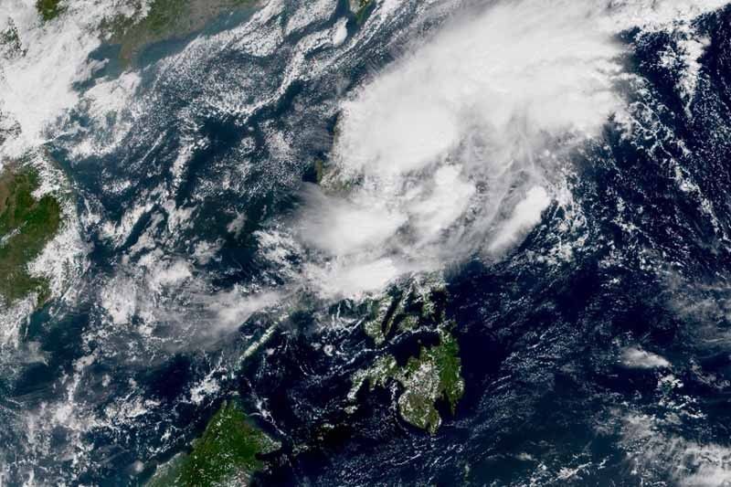
MANILA, Philippines — State weather bureau PAGASA placed nine areas in Luzon and Visayas under Tropical Cyclone Wind Signal No. 1 as Tropical Storm Ramon (Kalmaegi) continues to make its way toward Northern Luzon.
As of 11 a.m. Thursday, TCWS No. 2 remains hoisted over Catanduanes. Winds between 61 kph and 120 kph may be expected in the province in at least 24 hours.
TCWS No. 1, meanwhile, is raised over:
- Eastern portion of Isabela (Divilacan, Palanan, Dinapigue)
- Northern Aurora (Dilasag, Casiguran, Dinalungan)
- Polillo Island
- Camarines Norte
- Camarines Sur
- Albay
- Sorsogon
- Eastern Samar
- Northern Samar
Those living in these areas may experience winds between 30 and 60 kph or intermittent rains in at least 36 hours.
The tropical storm was last seen 290 km east northeast of Virac, Catanduanes or 410 km east of Daet, Camarines Norte.
It still carries peak winds of 65 kph near the center and gusts of up to 80 kph.
“Ramon” slightly gained speed and changed its movement. It is now heading north northwest at 20 kph.
The tropical storm is expected to stay inside the Philippine Area of Responsibility until November 20.
The latest forecast track of “Ramon” shows the tropical storm could make a landfall over the northern Isabela-Cagayan area on Sunday morning. It is also expected to cross Northern Luzon on Sunday.
“Ramon” may exit the Philippine landmass by Monday morning but it may stay inside the country’s jurisdiction until Wednesday, weather specialist Raymond Ordinario said.
It will continue to bring light to moderate with intermittent heavy rains over Bicol region, Quezon and eastern portions of Isabela and Cagayan today.
By Friday, those living in the eastern portion of Cagayan and Isabel may experience light to moderate with occasional heavy rains. Meanwhile, light to moderate with intermittent heavy rains may affect Apayao, Quirino, Northern Aurora and the rest of Cagayan and Isabela.
Forecast positions
- Friday morning: 285 km east of Baler, Aurora
- Saturday morning: 170 km east of Casiguran, Aurora
- Sunday morning: In the vicinity of San Mariano, Isabela
- Monday morning: 45 west southwest of Laoag City, Ilocos Norte
- Tuesday morning: 210 west of Sinait, Ilocos Sur


- Latest
- Trending