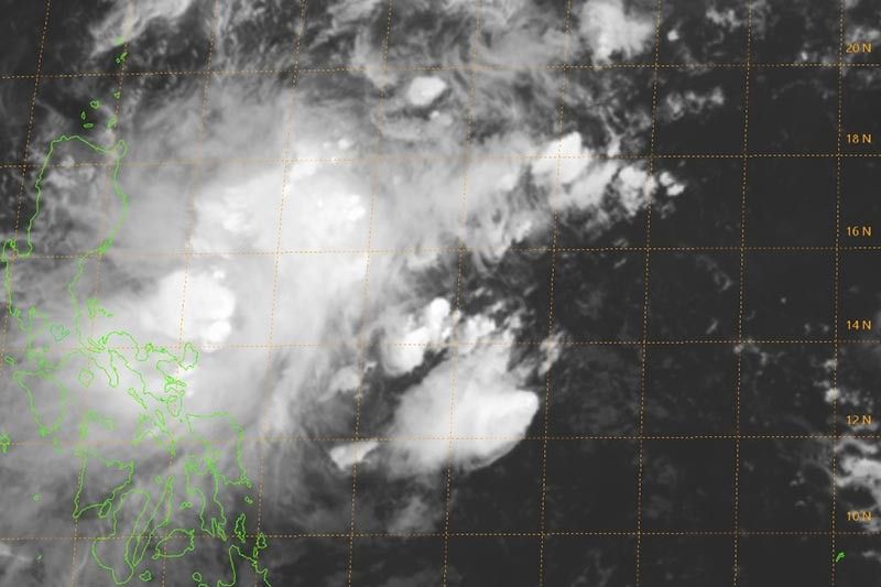
Catanduanes now under Signal No. 2 due to ‘Ramon’

MANILA, Philippines — The province of Catanduanes has been placed under Tropical Cyclone Wind Signal No. 2 as Tropical Storm Ramon (Kalmaegi) slows down.
State weather bureau PAGASA said those living in Catanduanes may experience winds between 61 kilometers per hour and 120 kph in at least 24 hours.
Signal No. 1, meanwhile, remains hoisted over Camarines Norte, Camarines Sur, Albay, Sorsogon, Eastern Samar and Northern Samar.
At 4 p.m., “Ramon” was spotted 390 km east of Catarman, Northern Samar with peak winds of 65 kph near the center and gusts of up to 80 kph.
It slightly slowed down, now moving west northwest at 10 kph from the previous 15 kph.
“Ramon” may dump light to moderate with occasional heavy rains over eastern portion of Cagayan, Isabela, Camarines Norte, Camarines Sur and Catanduanes until Thursday afternoon.
Meanwhile, light to moderate with intermittent heavy rains may affect Apayao, Aurora, Quezon, and the rest of Cagayan, Isabela and Bicol region.
Between Thursday afternoon and Friday afternoon, those living in the eastern portion of Cagayan and Isabela may experience light to moderate with occasional heavy rains as “Ramon” heads north. Meanwhile, light to moderate with intermittent heavy rains may affect Bicol region, Marinduque, Romblon, Quezon, Aurora and Apayao.
PAGASA warned that sea travel, especially for small sea vessels, over the seaboards of areas under TCWS, the seaboards of Northern Luzon, and the eastern seaboards of Central and Southern Luzon.
The state weather bureau also said that Signal No. 1 may be hoisted over Polillo Island in the next bulletin.
“Ramon” is expected to make a landfall over northern Aurora or Isabela on Saturday.
Cyclone outside PAR
PAGASA is also monitoring a tropical storm outside the Philippine Area of Responsibility. Tropical Storm Fengshen was last seen 3,245 km east of Southern Luzon.
It bears maximum winds of 75 kph and gusts 90 kph. Moving west at 25 kph, the tropical storm is not expected to enter PAR.
Forecast positions of ‘Ramon’
- Thursday afternoon: 160 km northeast of Virac, Catanduanes
- Friday afternoon: 250 km east of Baler, Aurora
- Saturday afternoon: In the vicinity of Ilagan, Isabela
- Sunday afternoon: In the vicinity of Capacuan, Cagayan
- Morning afternoon: 105 km northwest of Laoag City, Ilocos Norte
- Latest
- Trending


