LPA seen to merge with Tropical Depression Nimfa
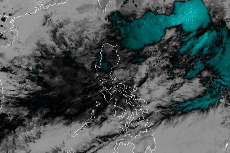
MANILA, Philippines — A low pressure area is expected to merge with the trough of Tropical Depression Nimfa, which is moving slowly over the Philippine Sea.
“Nimfa” was last spotted 745 kilometers east northeast of Basco, Batanes, maintaining its maximum sustained winds of 55 km per hour near the center and gusts of up to 70 kph.
Moving northeast slowly, the tropical depression is forecast to exit the Philippine Area of Responsibility on Saturday.
Meanwhile, the LPA in the vicinity of Sto. Tomas, La Union is expected to merge with the extension of “Nimfa” within 48 hours.
No storm signal has been raised yet but the trough of “Nimfa” will bring rains over Cagayan Valley, Cordillera Administrative Region and some parts of Ilocos region.
The LPA will affect the western section of Luzon, while the southwest monsoon will dump rains over Central and South Luzon as well as Western Visayas.
Monsoon rains will prevail over Central Luzon, Pangasinan, Palawan and Mindoro provinces until Thursday morning. Residents of Metro Manila, and the rest of Luzon and Western Visayas will experience light to moderate rains with intermittent heavy rainshowers.
Sea travel remains risky over the northern and eastern seaboards of Northern Luzon due to rough to very rough sea conditions. — Gaea Katreena Cabico


- Latest
- Trending