PAGASA monitoring potential tropical cyclone off Mindanao
MANILA, Philippines — While Typhoon Liwayway (Lingling) is crawling slowly over the Philippine Sea, a potential tropical cyclone is brewing off the waters of Mindanao.
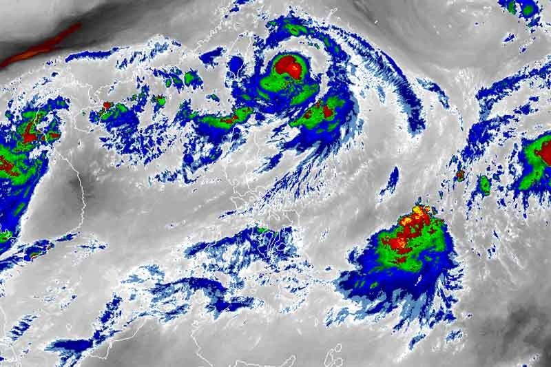
In a briefing late Wednesday morning, PAGASA weather specialist Loriedin De La Cruz said the agency is “closely monitoring” a low pressure area outside the Philippine Area of Responsibility.
The LPA was last spotted 1,050 kilometers east northeast of Mindanao. The weather disturbance is seen to develop into a tropical cyclone in the next few days.
“Although it is not 100% sure that it will become a tropical depression, we are not ruling out the possibility [that it may become one],” De La Cruz said.
It will be given local name “Marilyn” if it enters the country’s jurisdiction as a tropical cyclone.
Stationary Liwayway
“Liwayway” was last seen 345 kilometers northeast of Basco, Batanes with maximum sustained winds of 130 kilometers per hour near the center and gusts of up to 160 kilometers per hour.
The typhoon is moving north northeast slowly.
“Liwayway” is forecast to leave PAR on Thursday.
Between Wednesday and Thursday, residents of Batanes and Babuyan islands will experience light to moderate with intermittent heavy due to “Liwayway.”
The southwest monsoon, which is affecting the western portions of Luzon and Visayas, will bring scattered light to moderate with at times heavy rainshowers during thunderstorms over Ilocos region, Cordillera Administrative Region and Central Luzon.
Occasional gusty conditions may also occur in Batanes, Babuyan Islands, Ilocos region, CAR, Zambales and Bataan due to the southwest monsoon.
The trough or extension of “Liwayway” is expected to bring light to moderate with intermittent heavy rains over Batanes, Babuyan Islands and Ilocos provinces between Thursday morning and Friday morning.
PAGASA warned that sea travel is risky, especially for those using small seacrafts, over the northern and western seaboards of Luzon.
Forecast positions
- Thursday morning: 505 km northeast of Basco, Batanes
- Friday morning: 820 km north northeast of Basco, Batanes (outside PAR)
- Saturday morning: 1,495 km north of Basco, Batanes (outside PAR)
— Gaea Katreena Cabico


- Latest
- Trending