‘Liwayway’ seen to become typhoon on Wednesday
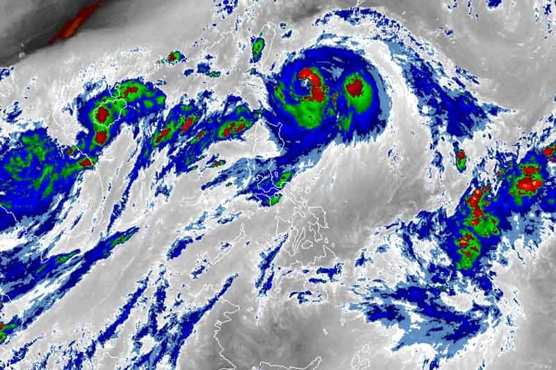
MANILA, Philippines — Severe Tropical Storm Liwayway (Lingling) may intensify into a typhoon on Wednesday afternoon before it leaves the Philippine Area of Responsibility, weather forecasters said.
“Liwayway” is expected to exit the country’s jurisdiction as a typhoon between late Wednesday evening and Thursday morning.
The severe tropical storm—last spotted 225 kilometers east of Basco, Batanes—now packs maximum sustained winds of 110 km per hour from the previous 95 kph. Its gusts also intensified to 135 kph from the previous 115 kph.
“Liwayway” is forecast to move north at 15 kph. No landfall is expected.
Batanes remains the only area under Tropical Cyclone Wind Signal No. 1. Residents of the province may experience winds between 30 to 60 kph or intermittent rains within 36 hours.
PAGASA also warned that sea travel remains risky over Luzon due to potentially rough sea conditions.
Between Tuesday and Wednesday afternoon, those living in Batanes and Babuyan Group of Islands will experience light to moderate with intermittent heavy rains due to “Liwayway.”
Meanwhile, scattered light to moderate rains with at times heavy rainshowers during thunderstorms will prevail over Ilocos region, Central Luzon, Metro Manila, CALABARZON, northern portions of Palawan (including Calamian Islands), Mindoro provinces and the rest of Cordillera Administrative Region due to the southwest monsoon.
Between Wednesday afternoon and Thursday afternoon, the trough or extension of “Liwayway” and the southwest monsoon will bring light to moderate with intermittent heavy rains over Batanes and Babuyan Group of Islands.
LPA off Mindanao
The state weather bureau said that the low pressure area spotted 1,375 kilometers east of Davao City may enter PAR on Thursday.
It has no direct effect on any part of the country as of now.
Forecast positions
- Wednesday afternoon: 385 km northeast of Basco, Batanes
- Thursday afternoon: 630 km north northeast of Basco, Batanes (outside PAR)
- Friday afternoon: 1,070 km north northeast of Basco, Batanes (outside PAR)


- Latest
- Trending