Signal No. 1 up over 7 areas; ‘Ineng’ may become severe tropical storm within 24 hours
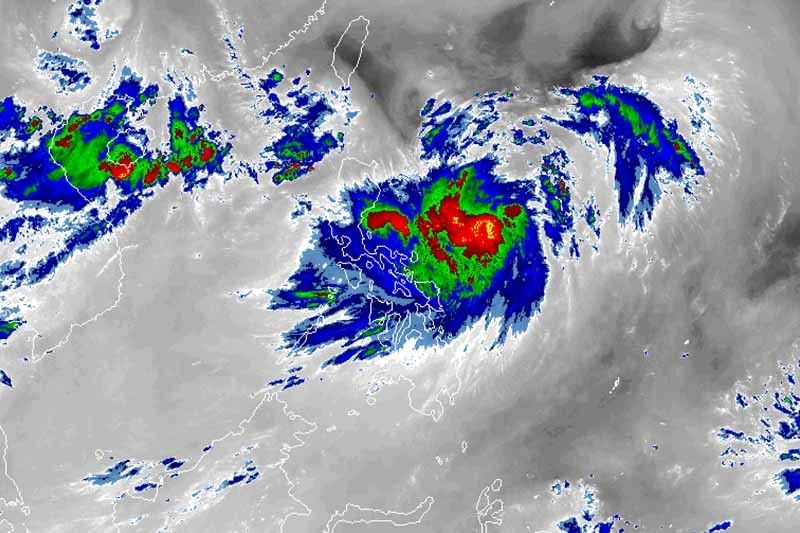
MANILA, Philippines — Seven areas in Northern Luzon are placed under Tropical Cyclone Wind Signal No. 1 as Tropical Storm Ineng (Bailu) slightly gained strength Thursday morning.
Weather forecasters raised TCWS Signal No. 1 over the following areas, where winds of 30 to 60 kilometers per hour or intermittent rains may be experienced within 36 hours:
- Batanes
- Cagayan including Babuyan Group of Islands
- Isabela
- Apayao
- Kalinga
- Northern Abra
- Ilocos Norte
“Ineng” was last spotted 725 km east of Casiguran, Aurora and was moving north northwest at 15 kph.
It packs maximum sustained winds of 75 kph from the previous 65 kph and gusts of up to 90 kph from the previous 80 kph.
The tropical storm remains less likely to make landfall in any part of the country but it may intensify into a severe tropical storm within 24 hours.
It is expected to leave the Philippine area of responsibility between late Saturday evening and early Sunday morning.
Residents of Bicol region, Northern Samar and Quezon province will experience moderate to occasionally heavy rains due to “Ineng.”
Meanwhile, light to moderate with intermittent heavy rains due to the southwest monsoon will prevail over Pangasinan, Zambales, Bataan, Cavite, Batangas, Mindoro provinces, northern Palawan—including Calamian and Cuyo islands—Antique and Aklan.
By Friday, moderate to occasionally heavy rains due to “Ineng” may be experienced over Batanes, Cagayan—including Babuyan Group of Islands—Isabela, Aurora and Quezon.
Resident of Metro Manila, the rest of Northern and Central Luzon, Cavite, Batangas, northern Palawan, Antique and Aklan may be affected by light to moderate with intermittent heavy rains due to the southwest monsoon.
Sea travel remains risky over the eastern seaboards of Southern Luzon, Visaya and Mindanao.
Forecast positions
- Friday morning: 520 km east of Calayan, Cagayan
- Saturday morning: 185 km north northeast of Basco, Batanes
- Sunday morning: 595 km northwest of Basco, Batanes (outside PAR)
- Monday morning: 1,030 km northwest of Basco, Batanes (outside PAR)
— Gaea Katreena Cabico


- Latest
- Trending