Signal No. 1 still up over Batanes, Babuyan as slow-moving 'Hanna' gains strength
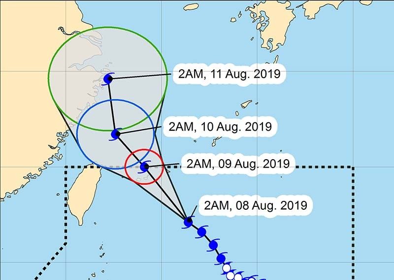
MANILA, Philippines — Typhoon Hanna has intensified as it slowly moves northwest, PAGASA said early Thursday morning as it warned of heavy rain in northern Luzon.
According to PAGASA's early morning weather briefing, "Hanna" was 485 kilometers east northeast of Basco, Batanes and has maximum sustained winds of 175 kilometers per hour near the center and gustiness of up to 215 kph as of 4 a.m.
Tropical Cyclone Wind Signal No. 1 remains raised over Batanes as well as the Babuyan Group of Islands as "Hanna" moves northwest at 15 kph.
PAGASA said northern Luzon should prepare for heavy rain because of the storm's outer rainbands.
The weather bureau also said a low pressure area within the Philippine Area of Responsibility and 270 kilometers west of Dagupan, Pangasinan is unlikely to either develop into a storm or make landfall.
"Hanna" and the LPA will nevertheless enhance the southwest monsoon or habagat, bringing rain to Luzon and the western section of the Philippines.
Typhoon Krosa, which PAGASA has also been monitoring, is 1,940 km east of the northernmost part of Luzon. It has winds of up to 120 kph near the center and gustiness of up to 150 kph. "Krosa" is slowly moving northwest and is not expected to enter the PAR.
Forecast position
Friday morning: 550 km east of Basco, Batanes
Saturday morning: 700 km north of Basco, Batanes (Outside Philippine Area of Responsibility)


- Latest
- Trending