


Signal No. 1 raised over Batanes, Babuyan Group of Islands as 'Hanna' inches toward northern Luzon
MANILA, Philippines — PAGASA raised Signal No. 1 over Batanes and the Babuyan Group of Islands as Severe Tropical Storm Hanna barrels nearer northern Luzon.
A landfall scenario, however, remains less likely, the state weather bureau said in an update on the weather disturbance at 11 p.m.
"Hanna" packs maximum sustained winds of up to 110 kph near the center and gustiness of up to 135 kph. This is slightly stronger than its recorded maximum sustained winds of 100 kph and gusts of 125 kph at 5 p.m. today.
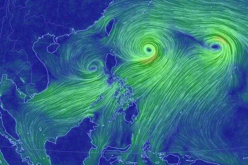
At 10 p.m. Tuesday, the center of "Hanna" was estimated at 730 km east of Calayan, Cagayan or 675 km east of Basco, Batanes. It is moving northwest at 10 kph.
PAGASA said moderate to heavy monsoon rains will be experienced over the northern portions of Palawan (including Calamian and Cuyo Islands), Occidental Mindoro, Oriental Mindoro, Romblon, Cavite, Batangas, Laguna, Zambales, Bataan, Aklan and Antique on Wednesday.
Cloudy skies with scattered rain showers and thunderstorms, meanwhile, will be experienced over Metro Manila, the rest of Luzon, Central Visayas and Western Visayas.
On Thursday, moderate to heavy monsoon rains are forecast over northern portions of Palawan (including Calamian and Cuyo Islands), Occidental Mindoro, Batangas, Cavite, Bataan, Zambales, Pangasinan and Ilocos Region. On the other hand, light to moderate to at times heavy rains will be experienced over Metro Manila, the rest of Luzon and Western Visayas.
PAGASA also advised fisherfolk and those with small seacraft not to venture out over the seaboards of areas under Signal No. 1, the eastern and western seaboards of northern and central Luzon, seaboards of southern Luzon and Visayas, and the northern and eastern seaboards of Mindanao due to potentially rough sea conditions.
2 other weather systems being monitored
Meanwhile, two other weather systems are being monitored by the state weather bureau.
Tropical Storm Krosa, which is outside the Philippine area of responsibility, was estimated to be located at 2,215 km east of extreme northern Luzon at 10 p.m. Tuesday. It packs maximum sustained winds of 75 kph near the center and gustiness of up to 90 kph.
It is moving northwest at 10 kph and is less likely to enter PAR.
The low pressure area, on the other hand, was estimated to be located at 260 km west-northwest of Iba, Zambales or 295 km west of Dagupan City, Pangasinan.


- Latest
- Trending


