More areas under Signal No. 2 as Tropical Storm Falcon maintains strength
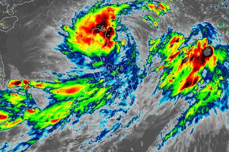
MANILA, Philippines (Updated 10 p.m.) — “Falcon” maintained strength hours after it intensified into a tropical storm Tuesday afternoon as it continues to threaten northern Luzon.
“Falcon” has intensified into a tropical storm at 2 p.m., state weather bureau PAGASA said in a severe weather bulletin at 5 p.m. Tuesday. The weather disturbance, however, will not develop into a typhoon.
In its bulletin at 8 p.m., PAGASA said the tropical storm continues to packs maximum sustained winds of 65 kilometers per hour and gusts of up to 80 kph.
Its center was last seen 250 km east-southeast of Tuguegarao City, Cagayan at 7 p.m. and is heading west at 30 kph.
Batanes is now included in the areas under Tropical Cyclone Wind Signal No. 2 along with the northeastern portion of Cagayan including Babuyan Group of Islands. Winds of 61 to 120 kph may be expected in these areas in 24 hours.
Signal No. 1, meanwhile, is up over:
- Rest of Cagayan
- Ilocos Norte
- Abra
- Apayao
- Kalinga
- Isabela
- Mountain Province
- Ifugao
- Northern portion of Aurora
- Northern portion of Nueva Vizcaya
- Northern portion of Quirino
Winds of 30 to 60 kph and intermittent rains may be expected within 36 hours in these areas.
PAGASA added that Signal No. 1 may be hoisted over the northern portions of Aurora, Quirino, Nueva Vizcaya and the rest of Abra, Mt. Province and Ifugao in the succeeding bulletins.
Sea travel is dangerous over the seaboards of areas under TCWS and the eastern seaboards of central Luzon, southern Luzon and the Visayas.
“Falcon” is expected to closely approach or make landfall over Babuyan-Batanes islands area Wednesday afternoon or evening and may leave the Philippine area of responsibility on Friday morning.
Moderate to heavy rains will be experienced over Ilocos, Cordillera Administrative Region, Cagayan Valley, Nueva Ecija, Aurora, Zambales, Occidental Mindoro, northern Palawan including Calamian and Cuyo Islands, Aklan, Antique, Capiz, Iloilo and Guimaras until Wednesday evening.
Residents of Metro Manila, Calabarzon, Bicol and the rest of Visaya, Central Luzon and Mimaropa, meanwhile, will experience light to moderate with at times heavy rains.
Between tomorrow afternoon and Thursday evening, moderate to heavy rains may prevail over Ilocos region, CAR and Cagayan Valley, while light to moderate with at times heavy rains may affect Metro Manila, Central Luzon, Calabarzon and Mimaropa.
Residents of these areas are advised to take precautionary measures, coordinate with local disaster risk reduction and management offices and monitor updates.
Forecast positions
- 24 hours (Wednesday afternoon): 80 km east-northeast of Calayan, Cagayan
- 48 hours (Thursday afternoon): 210 km north-northwest of Basco, Batanes
- 72 hours (Friday afternoon): 730 km north of Basco, Batanes (outside PAR)
- 96 hours (Saturday afternoon): 1,040 km north of Basco, Batanes (outside PAR)
— Gaea Katreena Cabico


- Latest
- Trending