Weakened ‘Rosita’ leaves Luzon landmass
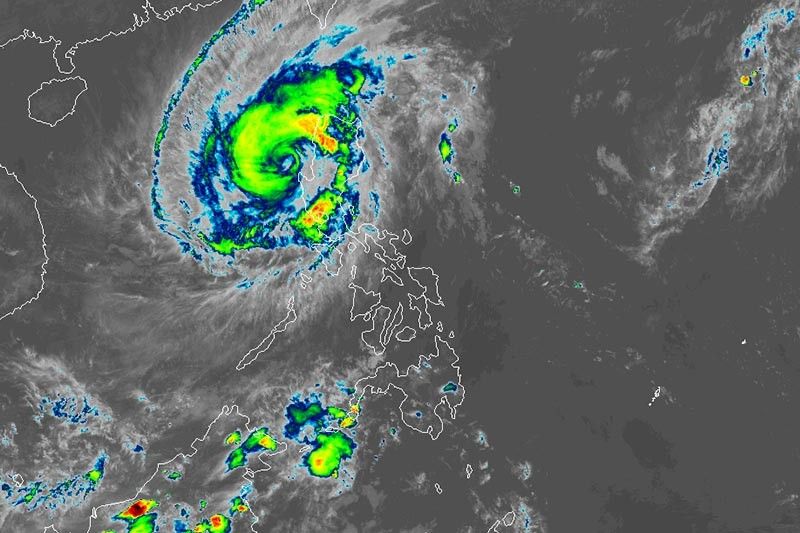
MANILA, Philippines — Typhoon Rosita (international name: Yutu) is now off to the West Philippine Sea after it cut across northern Luzon, state weather bureau PAGASA said late Tuesday afternoon.
Rosita weakened after leaving the province of La Union at 2 p.m. It now packs maximum sustained winds of 125 kilometers per hour from the previous 140 kph.
Its gusts also weakened to 190 kph from the previous 230 kph.
As of 4 p.m., the eye of Rosita was seen 125 km northwest of Dagupan City, Pangasinan. It is moving west northwest at 25 kph.
The typhoon’s high winds flattened flimsy homes, tore the roofs of others and downed power poles as well as trees.
Nearly 10,000 individuals fled their home ahead of Rosita’s arrival.
Tropical cyclone warning signals remain hoisted over the following areas:
Signal No. 3 (winds of 121 to 170 kph expected in at least 24 hours)
- Pangasinan
- La Union
Signal No. 2 (winds of 61 to 120 kph expected in at least 24 hours)
- Abra
- Ilocos Sur
- Benguet
- Mountain Province
- Nueva Vizcaya
- Nueva Ecija
- Tarlac
- Zambales
Signal No. 1 (winds of 30 to 60 kph expected in at least 24 hours)
- Ilocos Norte
- Apayao
- Kalinga
- Cagayan
- Isabela
- Quirino
- Aurora
- Bulacan
- Pampanga
- Bataan
- Metro Manila
- Rizal
- Cavite
- Laguna
- Batangas
Stormy weather will prevail over areas under Signal Nos. 2 and 3. PAGASA warned that travel by land is risky in these areas.
Residents of northern and Central Luzon will also experience moderate to heavy rains.
Storm surges of up to three meters high are possible along the coastal areas of Ilocos Sur, Ilocos Norte, La Union and Pangasinan.
Rosita is forecast to exit the country's landmass from 2 to 4 p.m. It will leave the Philippine area of responsibility Wednesday evening.
Forecast positions
- Wednesday morning: 295 km west of Sinait, Ilocos Sur
- Thursday morning: 460 km west northwest of Laoag City, Ilocos Sur (outside PAR)
- Friday morning: 520 km northwest of Laoag City, Ilocos Norte (outside PAR)
- Saturday morning: 515 km west northwest of Basco, Batanes (outsde PAR)
— Gaea Katreena Cabico with reports from the Agence France-Press


- Latest
- Trending