


‘Rosita’ heads for Benguet after battering Isabela
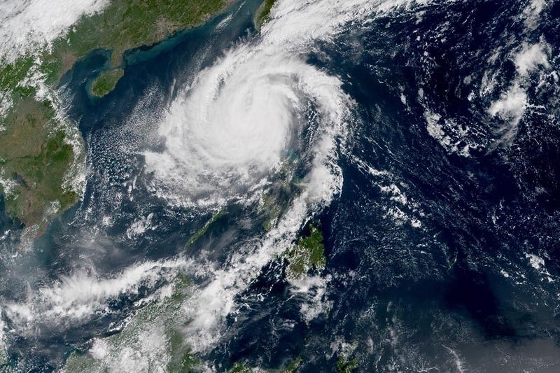
MANILA, Philippines — Typhoon Rosita (international name: Yutu) began heading for Benguet Monday morning hours after making landfall in Isabela.
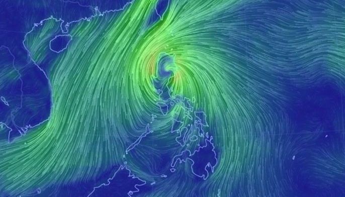
In its 11 a.m. bulletin, state weather bureau PAGASA said "Rosita" was already in the vicinity of Bambang, Nueva Vizcaya. It is moving west southwest toward Benguet at 25 kilometers per hour.
Aside from Benguet, the typhoon will also traverse over the provinces of La Union and Pangasinan.
The strength of "Rosita" remained unchanged with maximum sustained winds of 140 kph near the center and gusts of up to 230 kph.
Tropical cyclone warning signals have been raised in the following areas:
Signal No. 3 (winds of 121 to 170 kph expected in at least 24 hours)
- Ifugao
- Nueva Vizcaya
- Benguet
- Mountain Province
- Ilocos Sur
- Pangasinan
- La Union
Signal No. 2 (winds of 61 to 120 kph expected in at least 24 hours)
- Cagayan
- Isabela
- Quirino
- Aurora
- Ilocos Norte
- Apayao
- Abra
- Kalinga
- Nueva Ecija
- Tarlac
- Zambales
- Pampanga
Signal No. 1 (winds of 30 to 60 kph expected in at least 24 hours)
- Babuyan Group of Islands
- Bulacan
- Northern Quezon including Polillo Island
- Bataan
- Rizal
- Metro Manila
- Cavite
- Laguna
- Batangas
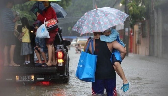
Stormy weather will prevail over areas under Signal Nos. 2 and 3. PAGASA warned that travel by land is risky in these areas.
Residents of northern and central Luzon will also experience moderate to heavy rains.
There may be storm surge of up to three meters in the coastal areas of Ilocos Sur, Ilocos Norte, La Union and Pangasinan.
Classes have also been suspended in various areas due to "Rosita."
The typhoon is seen to exit the country's landmass this afternoon and leave the Philippine area of responsibility by Wednesday evening.
Forecast positions
- Wednesday morning: 255 km west of Sinait, Ilocos Sur
- Thursday morning: 430 km west northwest of Laoag City, Ilocos Norte (outside PAR)
- Friday morning: 520 km west northwest of Laoag City, Ilocos Norte (outside PAR)
- Saturday morning: 565 km northwest of Laoag City, Ilocos Norte (outside PAR)
— Gaea Katreena Cabico


- Latest
- Trending


