‘Paeng’ continues to weaken, slow down
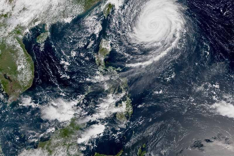
MANILA, Philippines — Typhoon Paeng has reduced strength anew as it continues to move away from the country at a slow pace, state weather bureau PAGASA said Wednesday morning.
“Paeng” now packs maximum sustained winds of 160 kilometers per hour near the center from the previous 190 kph. Its gustiness also decreased to 195 kph from the previous 235 kph.
As of 10 a.m., the eye of “Paeng” was seen 735 kilometers east of Basco, Batanes. It is heading north slowly.
Although no tropical cyclone warning signal has been raised, the typhoon is expected to bring light to at times moderate rains over northern Luzon starting Friday.
PAGASA warned that travel by sea remains risky over the northern and eastern seaboards of Luzon and eastern seaboard of Visayas.
Typhoon Paeng is forecast to leave the Philippine Area of Responsibility on Saturday.
Forecast positions
- Thursday morning: 740 kilometers east of Basco, Batanes
- Friday morning: 670 kilometers east northeast of Basco, Batanes
- Saturday morning: 630 kilometers north northeast of Basco, Batanes (out of PAR)
- Sunday morning: 1,145 kilometers north northeast of Basco, Batanes (out of PAR)
— Gaea Katreena Cabico
Related video:


- Latest
- Trending