LPA intensifies into tropical storm as it enters Philippines
MANILA, Philippines - The low-pressure area being monitored by the state weather bureau in the past days intensified into a tropical storm yesterday afternoon and is expected to enter the Philippine area of responsibility within the next 24 hours.
As of 4 p.m. yesterday, the tropical storm with international name Melor was spotted at 1,240 kilometers east of Hinatuan, Surigao del Sur, the Philippine Atmospheric, Geophysical and Astronomical Services Administration (PAGASA) said.
It packed winds of 65 kilometers per hour near the center with gustiness of up to 80 kph. It is forecast to move west-northwest at 25 kph.
The storm will be given the local name Nonoy once inside the Philippine area of responsibility. It will be the 14th tropical cyclone to enter the country this year.
PAGASA said the weather disturbance is expected to bring moderate to occasionally heavy rains over the eastern section of Southern Luzon and the Visayas beginning tomorrow as it continues to approach Eastern Visayas and the Bicol region.
“Flashfloods and landslides are possible,” the weather agency warned.
The cyclone is expected to be at 1,010 km east of Surigao City this morning and at 445 km east of Borongan City by tomorrow morning.
By Monday morning, it is expected to be at 220 km northeast of Borongan City; 70 km East of Virac, Catanduanes by Tuesday morning and at 205 km east of Infanta, Quezon by Wednesday morning.
Fair weather is expected to persist in most parts of the country, except for cloudy skies with light to moderate rains and isolated thunderstorms over Sarangani, South Cotabato and Davao del Sur today.
The northeast monsoon will bring cloudy skies with light rains over Batanes and the Calayan and Babuyan islands, while partly cloudy to cloudy skies with isolated light rains will be experienced over Metro Manila and the rest of Luzon.
For the rest of the country, it will be mostly partly cloudy to cloudy skies with isolated rainshowers or thunderstorms.
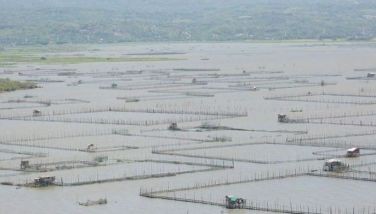
Meanwhile, with the expected entrance of Nonoy to the country, the Philippine Coast Guard (PCG) yesterday advised fishermen not to sail in the eastern border to prevent them from being trapped in bad weather.
PCG spokesman Commander Armand Balilo said they have issued an advisory informing fishermen in Bicol, Eastern Visayas and Eastern Mindanao not to venture out to sea.
“PCG officer-in-charge Rear Admiral William Melad has ordered Coast Guard districts in concerned areas to coordinate with local government units to monitor and prevent fishermen from leaving the shore, especially if there is a prevailing bad weather condition,” Balilo said. – With Evelyn Macairan, Jaime Laude


- Latest
- Trending