'Chedeng' to enter PAR tonight
MANILA, Philippines - Super typhoon "Maysak" (international name) is expected to enter the Philippine Area of Responsibility (PAR) on Wednesday night.
The United States' Joint Typhoon Warning Center earlier warned that the tropical cyclone, which will be called "Chedeng" once it enters PAR, will continue to intensify into a super typhoon.
READ: US agency upgrades 'Maysak' to super typhoon
According to the Philippine Atmospheric, Geophysical and Astronomical Services Administration (PAGASA), the typhoon will not directly affect the country once it enters but may bring rains and winds by weekend over Northern and Central Luzon.
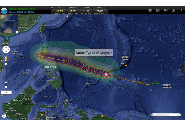
Tropical cyclone with international name "Maysak" is forecasted to intensify into a super typhoon.
As of 4 a.m. on Wednesday, the typhoon packs maximum sustained winds of 215 kilometers per hour (kph) near the center and gustiness up to 250 kph.
The local bureau will only declare it as a super typhoon once its winds reach a strength of 220 kph.
The typhoon was last located 1,410 km east of Surigao City. It is forecasted to weaken as it nears land.
"Ine-expect natin na bahagya po itong hihina habang papalapit dito po sa ating landmass," PAGASA weather forecaster Samuel Duran said in an interview with radio dzMM.
The typhoon is expected to make landfall over Northern or Central Luzon, particularly Aurora, Cagayan, Isabela, Quezon and Bicol region by Friday or Saturday.
RELATED: Philippines to feel effects of 'Chedeng' by weekend


- Latest
- Trending