PAGASA: 10 to 13 typhoons expected until November
CEBU, Philippines — More tropical cyclones, locally known as "bagyo," are expected to develop and enter the Philippine Area of Responsibility (PAR) after typhoon Domeng, says Philippine Atmospheric, Geophysical and Astronomical Services Administration (PAGASA)-Mactan chief Alfredo Quiblat Jr.
Quiblat said they are expecting at least 10 to 13 tropical cyclones to enter PAR and may cross the country's landmass starting this month until November.
The state weather bureau already recorded one, which is Domeng - the fourth tropical cyclone to enter PAR this year. Domeng has already exited the PAR yesterday.
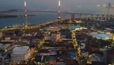
Though weather disturbances usually cross Luzon region during these periods, he said the presence of tropical cyclones cause to enhance the strength of the southwest monsoon or Habagat that may bring rains to Visayas regions, including Cebu.
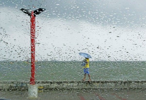
The southwest monsoon is the warm and moist winds that originate from the South Indian Ocean or the Australian continent bringing rains over the western portion of the country. Quiblat said it induces torrential rains to the country if intensified by tropical cyclone or a low pressure system.
It typically occurs from June to September and one of the contributing factors that causes rains in the country during the wet season. The southwest monsoon is one of the two major wind systems that affect the weather conditions of the country; the other is the northeast monsoon or "Amihan."
Quiblat explained that the rainy season has been closely associated with the frequent occurrence of tropical cyclones. He said during the rainy season, the sea surface temperature over the Pacific Ocean is hotter than during the dry season. The ocean's latent heat is the main energy source of tropical cyclones to where they slowly begin to form.
Based from PAGASA's 1948-2010 mean, an average of 20 tropical cyclones enters PAR but only 10 cross the country's landmass. PAR refers to the imaginary boundary enclosing the Philippine waters and landmass.
In June alone, an average of one to two tropical cyclones is expected to develop and enter PAR. But tropical cyclones typically become more frequent from July to September.
Philippines is very much vulnerable to natural calamities like tropical cyclones because of its geographical location; the country is near the Pacific Ocean basin where low atmospheric pressure initially forms and turns into tropical cyclone.—/FPL (FREEMAN)


- Latest