Shelter from the storm: Coastal greenbelts of mangroves and beach forests
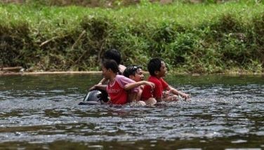
The human cost from recent Super Typhoon Yolanda (international name: Haiyan) approaches more than 10 million affected (10 percent of our total population) in 41 provinces, and damage of $12-15 billion (five percent of our GDP), even as we are shocked and awed by the superlatives that describe it — the strongest typhoon, at Category 5, ever to touch land with a diameter of 1,750 kilometers wide enough to cover the width of the archipelago and to make five consecutive landfalls, with strong gusts up to a maximum of 315-375 kph that caused devastating storm surges in Eastern Samar, Tacloban and other coastal areas.
Storm surges occur when atmospheric disturbances such as typhoon winds cause coastal waters to surge or move onto land (McIvor et al., 2012b). In contrast, tsunamis are caused by earthquakes and other perturbations in the earth’s crust. Yolanda created surges up to five meters high which were described by some radio and TV announcers as tsunami waves. Surges and tsunamis have different causes, although they may have overlapping heights (three to eight meters for storm surges and five to 20 meters for tsunamis) with damaging effects that are alike. Both phenomena can result in similar flooding depths and extent of inundation, factors which determine the destructiveness of a storm, together with flooding duration and height of waves on top of the storm surge. The total height of seawater during storms is the sum of tide level + storm surge + wind waves on top of the surge (Fig. 1– storm surge, waves). Wind waves are those generated near the coast, swell waves originate farther away and have longer wave lengths and periods. Surges that occur during (lunar) high spring tide when the sea is at its maximum level cause greater damage from deeper and longer flooding.
Mangrove instructional modules
A school module published in 2009 — the Mangrove Resource and Instruction for Elementary Grades — already differentiated storm surges from tsunamis. Funded by P1 million from my Pew Fellowship grant to cover module writing, production and printing costs, I convinced the teachers-writers of the need to include natural disasters. The future citizens of our typhoon-/earthquake-/flood-prone country should be enlightened at the earliest possible time through formal education on the nature of these disasters so they are better prepared. Complimentary copies of the modules and companion Teachers’ Manual were sent to some 200 public schools, mainly in Panay and Guimaras. For wider impact, I wrote (to two secretaries, two undersecretaries, various officials and consultants) and visited the main office of the Department of Education, to request mainstreaming of the modules in coastal schools all over the country. Half a dozen letters and three personal visits accomplished nothing. Now, the Mangrove Educational Series for Secondary Schools has come off the press. It describes earthquakes by way of a lesson on Plate Tectonics, and explains the protective role of mangroves when a tsunami strikes. But this time, I will call directly on my network of educator-friends, LGU officials, NGOs and coastal high schools willing to try out these modules, never mind the DepEd.
An accident of geography — some 7,100 islands in the Western Pacific (where a full 30 percent of all storm events occur) lying 5o above the equator — makes the Philippines among the most typhoon-blighted countries on the planet. The narrow band of 5 o above and below the equator, including Malaysia and Indonesia, is storm-free because of the Coriolis effect (McIvor et al., 2012b). To date, we have racked up 26 typhoons for 2013, using up the last letter in the alphabet (Zoraida) that we need to go back to A for any more typhoons. Storms are called different names according to their origin — hurricanes in the Americas, cyclones in South Asia and typhoons in the Philippines. If the woes of other countries provide any consolation, note that the loss of Filipino lives in the tens of thousands per typhoon increases exponentially for South Asian cyclones. An estimated 300,000 persons perished from each of the following: Cyclone Hooghly (India, 1737), Buckerganj and Bhola (Bangladesh, 1876 and 1970) and >100,000 from Nargis (Myanmar, 2008).
For so long, we Filipinos have ignored Nature’s warnings — a yearly average of only 100 persons dead + missing as of 2003, and $400 million damage, as of 2008. But climate change and the environmental crisis have upped the ante to higher estimates of 10,000 dead + missing and $12-15 billion damage to infrastructure and agriculture from a single typhoon (Yolanda). We should bring back Nature’s defenses, the coastal greenbelts comprising the intertidal mangroves and the beach forests above the high tide line (Figs. 2a&b – greenbelts, lack).
Beach forests
By now, most Filipinos are familiar with mangroves, hence the popularity of mangrove planting and mangrove runs, especially among the youth and civil society. But not the supratidal beach forest (which is the ecosystem above the mangroves and below the lowland and cloud forests) as this was the very first vegetation to be cleared by our early ancestors so they could build their houses, churches, schools and shops. Beach flora comprise 150-200 species, including 70-100 trees such as talisay, dangcal, ipil, calumpang and dapdap (Primavera and Sadaba, 2012: Beach Forests and Mangrove Associates in the Philippines). These are hardy, pioneering species that can tolerate full sunlight, low nutrients and salt spray, and should be part of the greenbelt vegetation above the high tide line. (Well-meaning but ecologically misguided experts recommend the planting of fast-growing bamboo varieties, but these cannot withstand storm surges and low water supply.) The distribution of beach forest trees and mangrove associates may start at the beach but do not end there. They can grow 200 kilometers inland (balabago, potat, argao are found in the Agusan Marsh) and 200, even 400, meters above sea level (balitbitan and dita trees thrive in Musuan, Bukidnon). This makes beach trees ideal species for the reforestation of bare, barren sites including proposed greenbelt areas under the DENR National Greening Program. A current GIZ (Deutsche Gesellschaft für Internationale Zusammenarbeit)-ZSL (Zoological Society of London) project aims to develop and collate nursery protocols for 15-20 beach trees for dissemination in hard and soft copies early next year.
4:1 mangrove-pond ratio
Over the last century, we lost almost all of our beach forests and around half of our mangroves (Long et al., 2013). But mangroves and ponds need not be mutually exclusive. Both early and more recent scientific literature point to a 4:1 mangrove-pond ratio required for ecological sustainability, so that coastal protection and other mangrove services can be provided at the same time as food from aquaculture ponds.
To achieve the ecologically sound 4:1 ratio, we need to protect remaining mangroves and rehabilitate degraded sites. Toward this end, the ZSL-CMRP project has documented in the Manual of Community-based Mangrove Rehabilitation (Primavera et al., 2012) both positive and negative learnings gleaned from the rearing of 58,000 seedlings of a dozen mangrove species in onsite nurseries, and the outplanting (Fig.3 – pagatpat plantation, Dumangas) of close to 100,000 wildings and nursery seedlings. All this was undertaken by 4,000 volunteers from people’s organizations, NGOs, professional organizations and church groups, students and teachers. Mangrove plantations cost a total of P115,200-P151,200 for each hectare inclusive of nursery seedlings, planting costs and plantation maintenance for one year. Expensive at first glance, but not so if we consider the countless lives snuffed out for lack of shelter from Yolanda’s fury. Hundreds of hard copies of the Manual have been sent to mangrove workers in and outside of government, and a soft copy can be downloaded below:
https://www.zsl.org/conservation/regions/asia/mangrove-philippines/iucn-mangrove-specialist-group,2261,AR.html
(Yet a major mangrove rehabilitation program of the government declined to use this set of science-based protocols because of its foreign funding.) Other means of disseminating information have been through intensive, hands-on Mangrove Rehabilitation Training Courses (five courses organized over three years), and posters, car stickers, and pins that feature basic mangrove guidelines and concepts.
But planting at the seafront, the favored practice among mangrove-interested groups, will not give us back the mangrove area we need for environmental sustainability. For one, it has notoriously high mortality rates because the lower intertidal to subtidal location is not ecologically favorable. But its open access character with no tenurial problems makes it the default planting zone — planting by convenience, rather than by ecology. Even if survival rates were to improve dramatically, the narrow band by the beach will yield only hundreds of hectares, not the thousands required. To achieve massive mangrove rehabilitation, we must target abandoned ponds, because this is where mangroves used to be. Consider the statistics — at present we have 240,800 hectares of mangroves (Long et al., 2013) and 232,000 hectares of fishponds. A 4:1 ratio means increasing mangroves to 378,240 hectares and reducing ponds to 94,560 hectares, by respectively adding and subtracting 137,440 hectares. Total yearly harvest of milkfish from these brackishwater ponds is 231,000 MT which can be produced in only 25,000 fish cages of 10m x 10m in coves and bays throughout the archipelago. Food security becomes less of an issue if ponds, especially those facing open seas and lining riverbanks, were to be reverted to mangroves for coastal protection, because fish cages can take up the shortfall.
A current GIZ-funded study shows that one-third of brackishwater ponds are under tax declaration (to local governments) or misdeclared, and therefore illegal as far as the national government is concerned. Another study (Ferrer et al., 2011) noted that cancelled Fishpond Lease Agreements (FLAs) should be higher than only 11 percent of total FLAs at present, due to numerous violations of lease condition, e.g., failure to pay fees and submit reports, expired leases, rampant subleasing. Therefore the area of 137,440 hectares needed for mangrove reversion to achieve the 4:1 ratio can be sourced from either tax declaration or abandoned FLA ponds. However, the DA-BFAR retains jurisdiction over abandoned FLA ponds by means of Fisheries Administrative Order 197-1 which includes an Aquasilviculture Service Contract by which a cooperative, enterprise or person can be awarded rights to operate for 10 years up to 50 hectares of ponds with remaining mangrove cover. In the first place, FLA ponds are forest lands under the jurisdiction of DENR lent to DA-BFAR way back in the 1970s for purposes of food production at a time when mangroves and other wetlands were viewed as wastelands. But if the storm protection value of mangroves is much greater (see mangrove valuation below), then the No Regrets option for abandoned ponds is to bring them back to mangroves (Fig. 4 — pond reverted to mangroves, Iloilo). Following the laws of man (as enumerated below) and of Nature (sea level rise and increasing storm frequency and intensity), how can we do otherwise?
Greenbelt laws
Dating back to the 1970s, our greenbelt laws require buffer zones of 50-100 meters facing open seas and 20-50 meters along riverbanks (e.g., Presidential Decree 705 of 1975, PD 953 of 1976, PD 1067, MNR Administrative Order 42 of 1986, DENR AO 76 of 1987). Even the 1998 Fisheries Code (Republic Act 8850) requires the retention or planting of greenbelts along fishpond dikes. But these laws have been observed more in the breach than in the compliance. As early as 1993, I noted that “an aerial view of the Philippine coastline will show pond after fishpond in monotonous succession with hardly any relief of green …†and called on their operators to plant mangroves as required by law. Then came the post-Asian tsunami period, and I recommended that greenbelts be established along seafronts and other vulnerable areas as a wall of trees can dampen a wall of water. Another eight years down the line, Yolanda has added storm surges to the list of disasters that require greenbelt protection.
The effectiveness of coastal greenbelts in reducing the wave energy of surges and tsunamis can be gleaned from both anecdotal and scientific reports. The village of MacArthur in Eastern Samar was buffered from the storm by a healthy mangrove stand nearby. Likewise, lush mangroves in Molocaboc, Sagay in nearby Negros Oriental shielded residents from the storm surge. Images of the wasteland that Tacloban has become, and also those of other towns without greenbelts, provide all the evidence. My personal tale from Yolanda comes by way of a brother who was visiting his daughter before the typhoon hit. Trapped in a house near the Tacloban Airport (where the daughter works as traffic controller), the surging waters forced him to scramble to the roof, and then jump into the water as surrounding houses collapsed one after the other. Clinging for dear life to an uprooted, yet immobile tamarind tree, he eventually made his way, with eyes smarting from salt water and one foot swollen from a nail wound, to the hospital where his daughter’s family, including a brand-new apo were safe.
Elsewhere in Southeast Asia, the loss of life (>100,000) and property caused by the 3.5-m surge from Cyclone Nargis that swept 40 km inland across Myanmar was due mainly to the conversion of 80 percent of mangroves in the Irrawaddy Delta to rice paddies and fish/shrimp ponds the last 75 years. All scientific evidence both from empirical data and numerical modelling suggests that mangroves can reduce storm surges by 5-50 cm per kilometer width of mangroves (Fig. 5 — wave attenuation). For wind and swell waves, even narrower mangrove bands of 100 meters and 500 meters can reduce wave height by 13-60 percent and 50-99 percent, respectively (McIvor et al., 2012a). In the absence of surges, mangroves may still confer benefits for the majority of typhoons that only have wind and swell waves. Expectedly, a full 80 percent of total value of mangrove goods and services estimated at $14,000-16,000/ha (=P600,000-700,000/ha) is contributed by coastal protection, including control of erosion and flooding (Barbier et al., 2011). The remaining values come from fisheries and forestry products, nutrient recycling and carbon sequestration.
A caveat — mangroves themselves may be subject to some damage as Nature’s bioshields; bigger, denser mangroves will have less damage than smaller, more spaced out trees (see Figure 5). But these plants are resilient and will recover, depending on the degree of damage and level of protection.
Conclusion
Coastal protection should integrate hard engineering (breakwaters, seawalls and levees) with soft engineering (beach and mangrove forests). In the aftermath of Typhoon Pedring, a 1.4-kilometer section of the Manila seawall was rebuilt at almost P100 million, all gray infrastructure with no touch of green. Likewise, disaster preparedness should cover a whole suite of interventions — early warning systems, elevated shelters, mangrove planting guided by science-based protocols, and long term public education. The President showed early signs of political will when he declared coastal sites as No-Build zones. To replace the inutile greenbelt stipulations hidden in forgettable sections of unenforced regulations, the Congress should enact a National Greenbelt Law. This will help the Executive branch of government to convince owners of commercial buildings, beach resorts and settlements along the seafront to relocate so that greenbelts can be put in place. Finally, the government should purchase land using the controversial PDAF and DAP budgets for the resettlement of low-income fishers and other coastal folk with no resources to move out of harm’s way. What better way to make us citizens feel that our government is indeed for us, the people — by transforming taxes squeezed from our blood, sweat and tears into green shelters that will keep us safe from any storm.
* * *
Jurgenne Primavera is chief mangrove scientific advisor of the Zoological Society of London; co-chair, IUCN Mangrove Specialist Group; Pew Fellow in Marine Conservation, and Scientist Emerita of the SEAFDEC Aquaculture Department. E-mail: [email protected]
* * *
References:
Barbier EB, Hacker SD, Kennedy C, Koch EW, Stier AC, Silliman BR. 2011. The value of estuarine and coastal ecosystem services. Ecol. Mono. 81(2): 169–193
Ferrer AJG, Hopanda JC, Orquejo MQ, Moscoso ADE and RB Sadaba. 2011. Reversion of disused fishpond lease areas to mangrove forest in Region VI, Philippines. EEPSEA Report No. 2011-RR9. Economy and Environment Program for Southeast Asia, Singapore
Long J, Napton D, Giri C and J Graesser. 2013. A mapping and monitoring assessment of the Philippines’ mangrove forests from 1990 to 2010. J. Coastal Research. DOI. 10.112/JCOASTRES-D-13.00057.1
McIvor, A.L., Möller, I., Spencer, T. and Spalding, M. (2012a) Reduction of wind and swell waves by mangroves. Natural Coastal Protection Series: Report 1. The Nature Conservancy and Wetlands International. 27 pages.
McIvor, A.L., Spencer, T., Möller, I. and Spalding, M. (2012b) Storm surge reduction by mangroves. Natural Coastal Protection Series: Report 2.The Nature Conservancy and Wetlands International. 35 pages.
Primavera JH and RB Sadaba. 2012. Beach forest species and mangrove associates in the Philippines. SEAFDEC Aquaculture Department, Iloilo, Philippines and UNESCO Office, Jakarta. 157 p.
Primavera JH, Savaris JD, Bajoyo B, Coching JD, Curnick DJ, Golbeque R, Guzman AT, Henderin JQ, Joven RV, Loma RA & Koldewey HJ. 2012. Manual for community-based mangrove rehabilitation. London, UK: Zoological Society of London, viii + 240 p.


- Latest