


Signal No. 1 sa Cagayan, Babuyan Islands areas itinaas dahil kay 'Siony'
MANILA, Philippines — Itinaas na ang tropical cyclone wind signal no. 1 sa ilang lugar kumikilos ito sa silangan ng dulong hilagang bahagi ng Luzon, ayon sa pahayag ng PAGASA ngayong Lunes.
Ilan sa mga lugar na inilagay sa signal no. 1 ay ang:
- hilagangsilangang bahagi ng Cagayan (Santa Ana, Gonzaga)
- silangang bahagi ng Babuyan Islands (Balintang Isl., Babuyan Isl., Didicas Isl., at Camiguin Isl. kasama ang kanilang islets)
Inaasahan ang mga hanging aabot ng 30-60 kilometro kada oras sa mga nabanggit na lugar sa susunod na 36 oras.
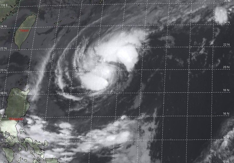
Bandang 4 a.m. nang matagpuan ang mata ng Tropical Storm Stiony 700 kilometro silangan ng Basco, Batanes at may lakas ng hanging aabot sa 85 kilometro kada oras malapit sa gitna.
May bugso itong papalo ng hanggang 105 kilometro kada oras at kumikilos nang mabagal sa direksyong timog timogkanluran.
"'SIONY' is forecast to move slowly or remain almost stationary in the next 12 hours. Afterwards, the tropical storm will move generally westward or west-northwestward towards the Luzon Strait and Extreme Northern Luzon," ayon sa state weather bureau.
"This will bring the center of 'SIONY' over or very close to the Batanes and Babuyan Islands between tomorrow evening and Friday morning."
Dahil dito, pwedeng-pwedeng mag-landfall sa mga nasabing lugar. Posible namang lumabas ng Philippine Area of Responsibility (PAR) ang bagyo Biyernes ng hapon o gabi.
Signal No. 3? Pwedeng mangyari
Nakikitang lalakas pa patungong severe tropical storm ang Tropical Storm Siony sa susunod na 24 oras at maaabot ang "peak intensity" nito na 100-110 kilometro kada oras bago mag-landfall o lumapit nang husto sa Extreme Northern Luzon.
Posible pa ring itaas ang Signal No. 3 sa "projected track" ng bagyo lalo na't kaya pa nitong umabot sa typhoon category, patuloy ng PAGASA.
"The combined effects of the northeasterlies and the trough of “SIONY” will bring light to moderate with at times heavy rains over Aurora, Quezon, Camarines Norte, Camarines Sur, Catanduanes, and the eastern portions of Cagayan and Isabela," paliwanag ng PAGASA.
"Flooding (including flashfloods) and rain-induced landslides may occur during heavy or prolonged rainfall especially in areas that are highly or very highly susceptible to these hazards and/or those that received significant antecedent rainfall from tropical cyclones 'PEPITO,' 'QUINTA,' and 'ROLLY.'"


- Latest


