


Signal 1 up in 5 areas as 'Ramil' maintains strength
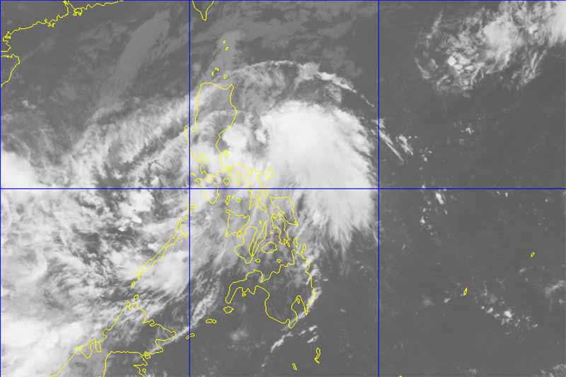
PAGASA hoisted Tropical Storm Warning Signal No. 1 in some areas as "Ramil" maintains its strength. PAGASA/Released
MANILA, Philippines — Storm Signal No. 1 was raised in several provinces on Wednesday as Tropical Depression Ramil maintained its strength and continued to move westward toward Calamian Group of Islands, the state weather agency said, dumping rains in large areas of the country as Filipinos troop to cemeteries today to commemorate All Saints' Day.
In its weather bulletin at 8:00 a.m., the Philippine Atmospheric Geophysical and Astronomical Services Administration placed under Tropical Storm Warning Signal No. 1 northern Palawan, including Calamian Group of Islands, southern Occidental Mindoro, southern Oriental Mindoro, Aklan and Antique.
PAGASA said that residents in these areas should expect 30 to 60 winds of 30 to 60 kilometers per hour in the next 36 hours.
"At 7:00 AM today, the center of Tropical Depression 'Ramil' was estimated based on all available data at 100 km east of Coron, Palawan," PAGASA said in its bulletin.
The weather agency said that "Ramil" was packing winds of up to 45 kilometers per hour near the center and gustiness of up to 60 kilometers per hour.
"Ramil" was moving westward at a speed of 20 kph, the weather agency added.
Estimated rainfall amount is between moderate to occasionally heavy within the 200-kilometer diameter of the tropical depression.
PAGASA also alerted residents of areas under Signal No. 1, as well as those in Metro Manila, Bicol Region, CALABARZON and the rest of MIMAROPA against possible flashfloods and landslides.
Sea travel is also risky in waters off the seaboards of northern Luzon and off the eastern seaboard of central and southern Luzon, PAGASA warned.
"Ramil" is expected to be 310 kilometers west of Coron, Palawan by tomorrow morning while it will be 155 kilometers north northwest of Pagasa Island, Palawan on Friday morning.
It is expected to exit the Philippine Area of Responsibility by Saturday morning when it is expected to be situated 290 kilometers west northwest of Pagasa Island.
The weather agency said that areas under Storm Signal No. 1 could experience very light to no damage to low-risk structures and light to medium damage to high-risk structures.
Houses made of very light materials or makeshift structures can also experience slight damage, it said.
However, rice crops already on their flowering stage in areas placed under Storm Signal No. 1 may suffer significant damage, according to the weather bureau.


- Latest
- Trending


